If you have time for one substantial hike near Boulder, I’d pick Lower Calf Creek Falls. Among Grand Staircase-Escalante hikes, it gives first-time visitors a memorable waterfall without tight squeezes or complicated route-finding.
Having said that, six sandy miles won’t suit everyone. The smartest first trip pairs one worthwhile hike with a shorter option, so let’s start with the choices that fit your energy and comfort level.
Key Takeaways
- Lower Calf Creek Falls is my first recommendation for hikers comfortable with a moderate, half-day outing.
- Willis Creek, Toadstool Hoodoos, and Devils Garden offer shorter alternatives with plenty of scenery.
- Peek-a-Boo, Spooky, and Coyote Gulch require more preparation than their mileage suggests.
- Bring water, download maps, and keep slot canyons off your itinerary when rain threatens.
Which Grand Staircase hikes fit your trip?
Here’s a shortlist of hikes in Grand Staircase-Escalante, ranked for first-time visitors rather than experienced canyon hikers.
| Hike | Approximate round-trip distance | Difficulty | Best reason to go |
|---|---|---|---|
| Lower Calf Creek Falls | 6 miles | Moderate | Tall waterfall |
| Willis Creek | 2.6 to 3 miles | Easy in dry conditions | Approachable slot canyon |
| Toadstool Hoodoos | 1.8 miles | Easy | Unusual rock formations |
| Devils Garden | About 1 mile, flexible | Easy to moderate | Arches and hoodoos |
| Escalante Natural Bridge | About 5.5 miles | Moderate | River canyon and natural bridge |
| Peek-a-Boo and Spooky | About 3.5 to 4.8 miles | Strenuous scrambling | Tight slot passages |
| Remote gulch route | About 10 to 12 miles on selected routes | Strenuous | Remote canyon scenery |
Distance alone doesn’t tell you the difficulty. Sand, heat, water crossings, scrambling, and exposure all matter here.
These trails are spread across southern Utah. Willis Creek sits near the western side, Toadstool Hoodoos near Kanab, and the remaining hikes farther northeast. Don’t build a day around visiting all three areas.
1. Lower Calf Creek Falls: My First Pick
The BLM’s Lower Calf Creek trail guide lists a six-mile round-trip distance and a 126-foot waterfall. Allow three to four hours of walking, plus time beside the pool.
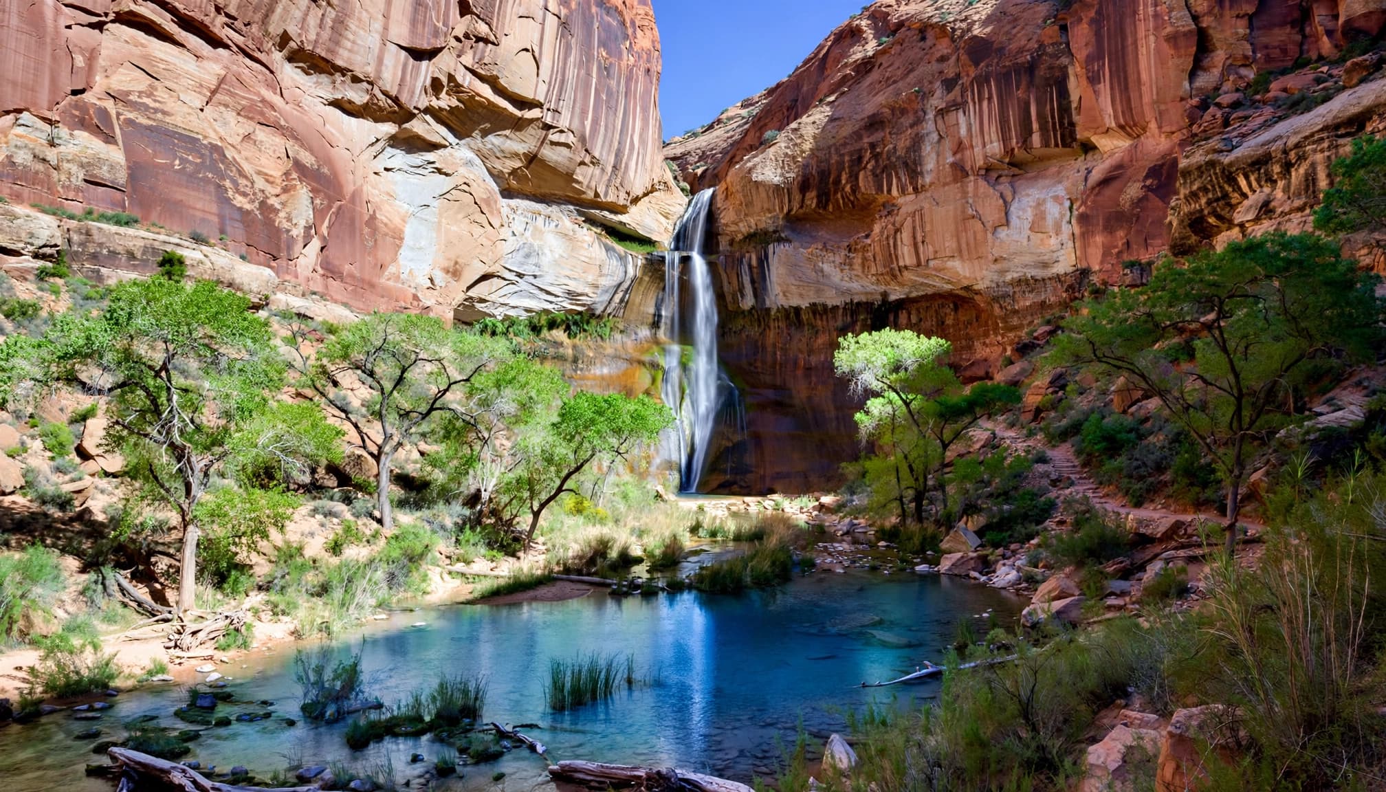
The trail starts at Calf Creek Recreation Area off Scenic Highway 12, between Escalante and Boulder. It’s a developed out-and-back route, but sandy stretches slow your pace.
I recommend an early start, especially in warmer months. Parking is limited, and the exposed stretches feel less comfortable at midday.
For a short waterfall hike, choose another route. The falls are roughly three miles from the trailhead, at the turnaround. If six miles exceeds your comfortable range, try one of the shorter hikes below instead.
2. Willis Creek: The Gentler Slot Canyon Choice
Willis Creek is the slot canyon I’d recommend first for families and beginners, as long as the weather is dry. A roughly 2.6 to 3-mile outing follows a shallow creek through sculpted sandstone passages.
Reach the trailhead via Skutumpah Road near Cannonville. The dirt-road approach is part of the planning, and mud can make access difficult.
Unlike Spooky, Willis Creek generally offers wider passages without the same squeezing and climbing. Expect wet patches, uneven stones, and possible slippery footing.
You can turn around before completing the full outing. That’s helpful if you’re managing tired kids or limited stamina, though this remains an unpaved canyon walk.
3 and 4. Short Hikes With Plenty of Scenery
3. Toadstool Hoodoos: Best for a Quick Stop
Toadstool Hoodoos is an easy, approximately 1.8-mile round-trip hike from a trailhead beside Highway 89 east of Kanab.
The payoff is a cluster of mushroom-shaped formations, with darker capstones balanced above lighter rock. You get distinctive Grand Staircase scenery without committing half your day.
I’d choose this over a longer canyon hike when you’re passing through or easing into desert walking. There’s little shade, though, and sandy footing still takes effort.
Keep to established paths and don’t climb the hoodoos. The formations are fragile, even when they look sturdy.
4. Devils Garden: Best for Flexible Exploring
Devils Garden offers hoodoos, sandstone shapes, and Metate Arch, about 12 miles down Hole-in-the-Rock Road.
Allow roughly a mile of wandering, depending on how much you explore. There’s no need to turn this into a long hike.
This is Escalante’s Devils Garden, separate from the trail of the same name in Arches National Park.
For hikers with knee limitations, keep the outing close to the parking area and avoid optional rock climbing. Sand and uneven slickrock mean “short” doesn’t equal wheelchair-accessible.
5. Escalante Natural Bridge: Be Ready for Wet Feet
Escalante Natural Bridge adds a different kind of challenge, with repeated river crossings beneath tall canyon walls along the Escalante River.
Plan for a moderate outing of about 5.5 miles and 12 river crossings on the commonly described route. Your exact route and turnaround affect those totals.
The Escalante Natural Bridge trailhead sits beside Scenic Highway 12 at the Escalante River crossing. Arrive early in summer because the small parking area fills quickly.
To keep hiking shoes and socks dry, remove them at each crossing and switch into secure water shoes. I wouldn’t recommend crossing barefoot over slippery, uneven stones.
Water depth and current matter more than the trail’s moderate rating when judging whether the river crossings are safe. If a crossing feels unstable, turn around. This is a poor choice for anyone whose balance or knees make repeated crossings difficult.
6 and 7. Adventure Routes to Plan Separately
6. Peek-a-Boo and Spooky: Short Miles, Serious Obstacles
Peek-a-Boo and Spooky are reached through the Dry Fork area after a long gravel-and-dirt drive on Hole in the Rock Road.
The combined outing runs roughly 3.5 to 4.8 miles, depending on the trailhead and route. The BLM’s Dry Fork guidance describes a 12-foot climb into Peek-a-Boo. Spooky has extremely narrow passages.
Use the narrow metal slot gauge near the trailhead to assess whether you can fit. Passing it doesn’t show whether you’re comfortable scrambling or moving through confined spaces.
The usual direction is up Peek-a-Boo and down Spooky. Carry the route offline so you can find the connecting trail and the correct canyon entrances.
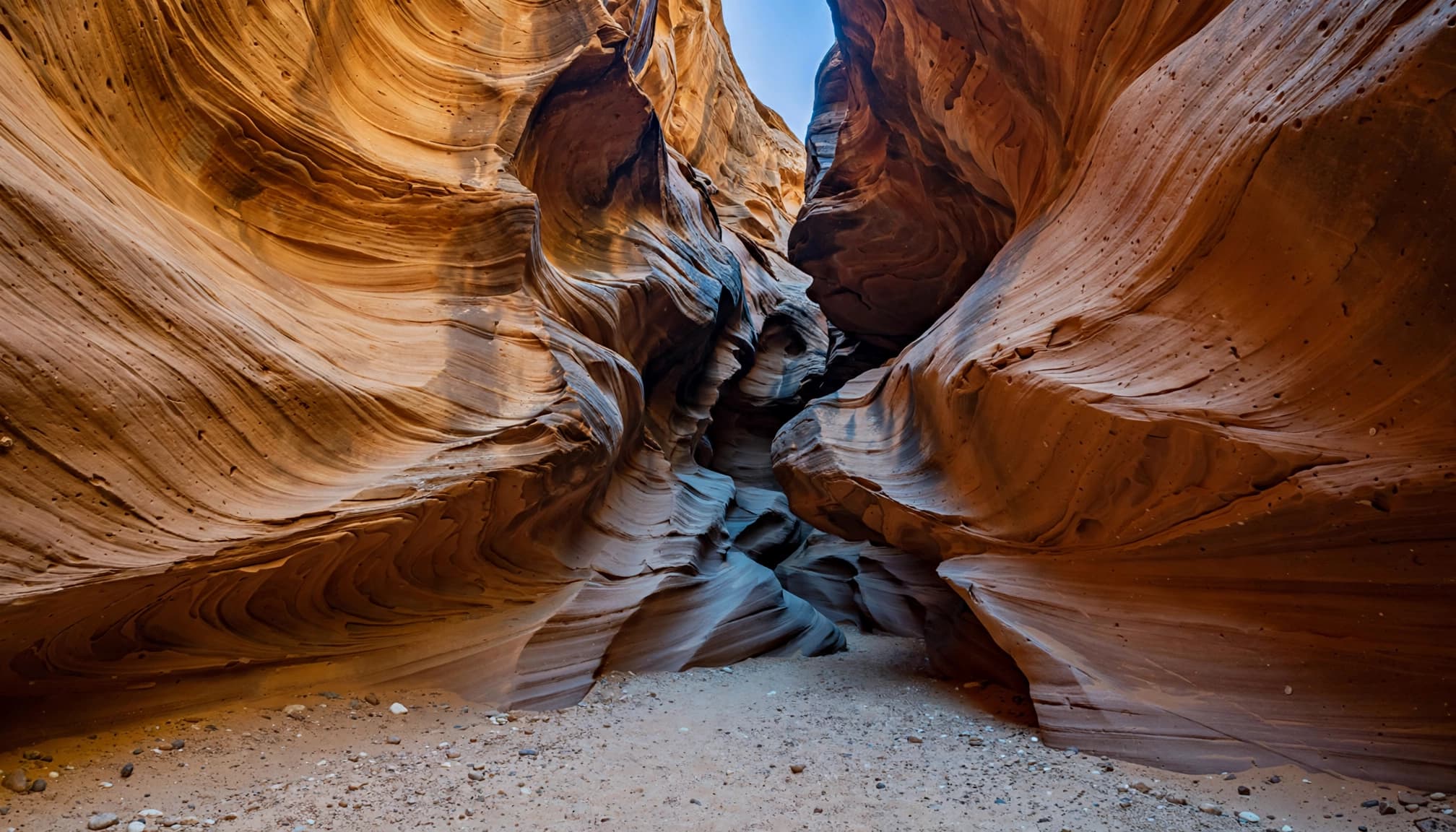
7. Coyote Gulch: Save It for a Prepared Hiking Day
Coyote Gulch deserves its reputation, but I’d leave it off a beginner’s casual itinerary.
Selected day-hike routes cover roughly 10 to 12 miles. Access choices can involve exposed slickrock, difficult exits, and substantially different distances. A shorter route can demand more climbing skill.
Under the National Park Service rules, day use doesn’t require a permit. Overnight camping requires a free backcountry permit, available at designated trailheads or visitor centers.
Choose your route deliberately rather than following whichever shortcut appears on a map.
Roads, Seasons, and Camping Logistics
Pick Your Season and Keep Driving Realistic
For comfortable desert hiking, I’d prioritize spring or fall. Summer brings intense heat and thunderstorm risk; winter can bring ice, snow, and muddy access roads.
Scenic Highway 12 connects Panguitch and Torrey over roughly 123 to 124 miles. Scenic Highway 12 climbs to around 9,000 feet near Boulder, so temperatures vary considerably.
The Grand Staircase-Escalante name describes five broad cliff levels stepping upward northward: Chocolate, Vermilion, White, Gray, and Pink. It doesn’t refer to a literal staircase trail.
If you’re extending the trip, my beginner-friendly Utah hiking guide helps you choose nearby park stops without stacking too many demanding days.
Treat Dirt Roads and Camping as Part of the Trip
Hole in the Rock Road runs roughly 56 miles toward the historic crossing where Mormon pioneers lowered 83 wagons through a steep cliff passage.
You don’t need to drive its full length for Devils Garden or Dry Fork. Still, washboard, sand, and storm damage can turn an approach into a slow drive. Avoid muddy roads, and don’t assume every spur suits a low-clearance vehicle.
The BLM’s monument camping guidance requires a free overnight permit for dispersed camping outside developed campgrounds. The usual stay limit is 14 days.
Fuel up in town and pack lunch. Roadside dining is too limited to build a hiking day around.
Flash Flood Safety, Water, and Offline Maps
Plan Around Flash Flood Risk in Slot Canyons
A flash flood is the biggest slot canyon hazard. To avoid one, don’t enter when rain is forecast for the drainage or falling nearby, including upstream.
Blue sky directly above you doesn’t guarantee safety. Water can arrive from a storm you never see.
The fatal floods at Little Wild Horse Canyon in 2020 and Antelope Canyon in 1997 show why you need firm limits to avoid a flash flood. The National Weather Service’s flash flood outlook covers southern Utah’s canyon areas.
A dry canyon floor tells you nothing about rain falling upstream. Make the decision before entering the narrows.
Carry Your Own Water and Offline Maps
Most of the monument has little or no cell service. Download and test offline maps before leaving town with AllTrails Plus (formerly Pro) or a Trailforks subscription.
Carry a charged phone and backup battery. In Trailforks, save the trailhead, approach road, and return route, not only the walking track.
For a moderate half-day hike, I recommend at least two to three liters of water per person, with more for heat or longer routes. Carry sun protection, snacks, a headlamp, and basic first aid.
Don’t count on untreated creek water or a working phone connection to rescue a poorly supplied day.
FAQs About Hiking Grand Staircase-Escalante
Is there a visitor center?
Yes. The Kanab Visitor Center is at 745 E. Highway 89, Kanab, UT 84741. The monument also has visitor centers serving its other areas.
Do Peek-a-Boo and Spooky require day-hiking permits?
No permit is required for ordinary day hiking through these slots. Overnight stays require a free permit. Permit-free access doesn’t make the scrambling beginner-friendly.
Which hike suits someone who needs easy miles?
Choose Toadstool Hoodoos for a short established outing or a brief Devils Garden visit. Willis Creek offers gentler slot scenery, but wet footing and dirt-road access add complications.
Is Escalante Natural Bridge beginner-friendly?
It can be, but the route has repeated creek crossings. Check current water conditions and be ready to turn back if the water is high.
Can I hike here without cell service?
Yes, if you download maps in Trailforks or another navigation app before your hike. Tell someone where you’re going and when you expect to return.
My Recommendation for Your First Visit
Start with Lower Calf Creek Falls if six moderate miles fit your abilities. Otherwise, choose a shorter hike and give yourself time to enjoy it.
The most rewarding first visit leaves you with energy to spare. Save the tight slots and remote canyon routes for a day when your preparation matches the terrain.