For most first-time visitors, hiking in Chiricahua starts with Echo Canyon Loop: 3.3 miles through towering volcanic rock formations, narrow passages, and shaded canyon bottoms. If you’re short on time or want gentler footing, start with Massai Point Nature Trail instead.
The best Chiricahua hikes don’t require huge mileage, but they do require attention to elevation, weather, and the climb back to your car. Chiricahua National Monument is in southeastern Arizona. Here’s how I’d choose a route and build a manageable first visit.
Key Takeaways
- For a moderate introduction to hiking, choose the canyon route and go counterclockwise.
- The 1.1-mile Heart of Rocks Loop is only the inner loop of a much longer outing, not a short roadside walk.
- Spring and fall offer the best balance of comfortable hiking weather and daylight.
- Entry and day hiking are free, but don’t build your itinerary around the currently unavailable hiker shuttle.
Choose Your Chiricahua Hikes by Effort
Chiricahua National Monument protects a volcanic sky island in the Chiricahua Mountains of southeastern Arizona. Its rhyolite pinnacles, or hoodoos, formed about 27 million years ago, unlike Utah’s familiar sandstone formations.
The monument has about 17 miles of hiking trails. Larger mileage figures for the surrounding mountains shouldn’t be confused with this compact trail network.
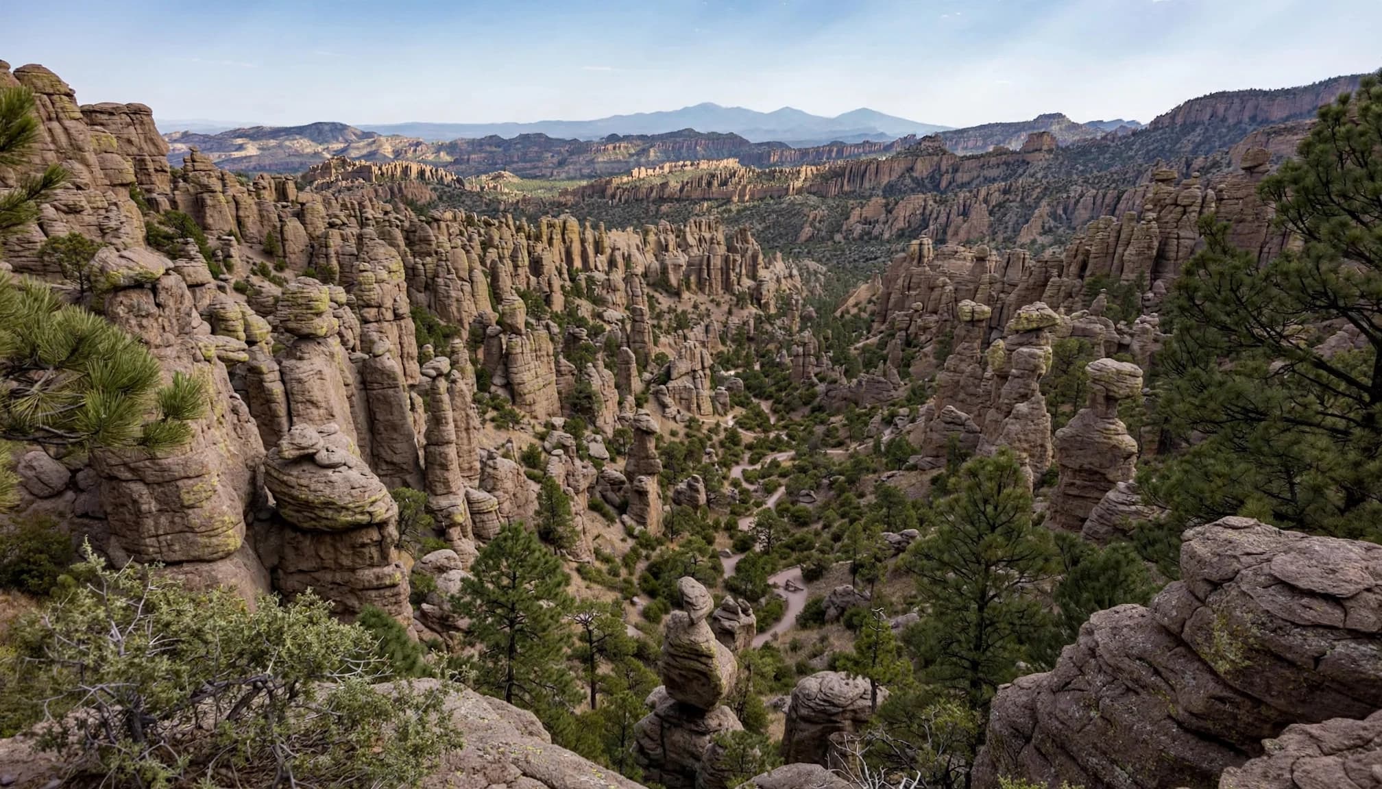
These distances are complete outings, not one-way trail segments.
| Hike | Total distance | Elevation gain | Effort | Access |
|---|---|---|---|---|
| Bonita Creek | 0.2-mile loop | Not listed | Easy | Bonita Creek trailhead |
| Silver Spur Meadow | 0.2-mile loop | Not listed | Easy | Silver Spur Meadow trailhead |
| Massai Point Nature Trail | 0.5-mile loop | Not listed | Easy | Massai Point |
| Sugarloaf Mountain | 1.8 miles | About 500 feet | Moderate | Sugarloaf trailhead |
| Echo Canyon Loop | 3.3 miles | About 560 feet | Moderate | Echo Canyon trailhead |
| Natural Bridge | 4.7 miles | Over 1,000 feet | Moderate, sustained | Natural Bridge trailhead |
| Heart of Rocks via Echo Canyon | 7.4 miles | Over 1,000 feet | Strenuous | Echo Canyon trailhead |
| Big Loop | 8.5 to 12 miles | Route-dependent | Strenuous | Usually Echo Canyon |
For beginners, I’d compare the hiking effort before choosing Massai Point, Echo Canyon, or Sugarloaf. Natural Bridge adds more climbing and commitment than its mileage might suggest.
Short Walks and Summit Views
Massai Point, Bonita Creek, and Silver Spur Meadow
Massai Point Nature Trail is my pick for visitors who want sweeping views without committing to a canyon descent. Allow roughly 30 minutes for the half-mile loop, longer if you’re stopping for photos.
Only the northern portion toward the exhibit building is paved. Don’t assume the entire loop has the same surface.
Bonita Creek and Silver Spur Meadow are shorter alternatives near the lower developed areas. They’re good beginner hiking options for stretching your legs, enjoying quieter surroundings, or keeping the day gentle. For the monument’s signature rock-spire views, though, Massai Point is the stronger choice.
Sugarloaf Mountain
Sugarloaf’s 1.8-mile round trip climbs to a historic fire lookout at 7,310 feet, the monument’s highest point.
I recommend it when you want broad, 360-degree views across Arizona rather than a long walk among the formations. Allow about 1.5 to 2 hours at an unhurried pace.
Keep in mind, short doesn’t mean flat. The roughly 500-foot climb, exposed stretches, and altitude make this a meaningful step up from Massai Point. Save it for clear weather, and avoid the summit when thunderstorms threaten.
Echo Canyon Loop: The Best First Full Hike
The route combines the Echo Canyon, Hailstone, and Ed Riggs trails into a 3.3-mile outing. Allow 2 to 4 hours for hiking, depending on your pace and photo stops.
Hike counterclockwise, descending Echo Canyon first and returning on Ed Riggs. That direction gives you a good introduction to the formations without saving the steeper Echo Canyon section for your final climb.
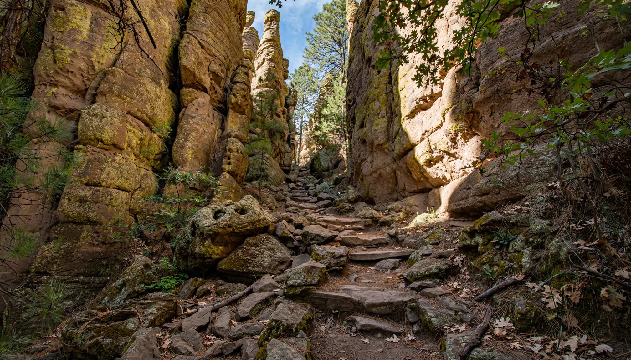
The Grotto is an early highlight, with sculpted rock formations and passages worth slowing down for. Farther along, the scenery alternates between open slopes and cooler canyon sections.
Echo Canyon starts downhill, but you’re hiking a loop. Budget energy and water for the return climb.
This is a suitable first full hike for visitors ready to spend a few hours hiking.
For a fuller day, pair Echo Canyon with Sugarloaf. Together, they total 5.1 miles.
That also qualifies for the Rock the Rhyolite hiking program. Participants hike at least 5 miles, photograph their outing, and report to the visitor center within seven days. Awards are available while supplies last.
Heart of Rocks and the Big Loop
Heart of Rocks requires a longer approach
The Heart of Rocks Loop itself is only 1.1 miles. Reaching it is where the effort comes in.
The 2026 NPS hiking guide lists a 7.4-mile round trip from Echo Canyon, with more than 1,000 feet of climbing. The visitor center approach is also listed at 7.4 miles, but gains about 1,600 feet. Approaches from Massai Point involve connecting trails, so the starting point matters.
Allow roughly 4 to 6 hours for a relaxed visit, including time among formations such as Punch and Judy and Camel’s Head. Follow the signed loop direction carefully.
I’d recommend this to beginners who already walk regularly and feel comfortable with a longer, rocky trail day.
The Big Loop is a full-day commitment
The Big Loop combines trails such as Echo Canyon, Upper Rhyolite, Heart of Rocks, and Mushroom Rock.
Descriptions often give 8.3 to 9.5 miles for particular versions. The 2026 NPS guide lists a wider 8.5-to-12-mile range, depending on the connections.
Choose your exact route before starting. Adding Inspiration Point or other side trips changes both mileage and effort.
For a first visit, I’d choose Heart of Rocks or Echo Canyon before attempting every connector. You’ll have more time to enjoy the formations without watching daylight disappear.
When to Go and What to Carry
Spring and fall are the easiest planning windows
March through May and September through November generally offer the most comfortable hiking conditions. Mild days in the 60s and 70s are possible, but elevation makes a big difference.
For hiking, I’d favor spring or fall over the broader September-to-May window. November through April can be pleasant, but winter brings snow and ice to higher trails.
Before hiking in Chiricahua, check current conditions and start early in summer. Keep distances conservative, and watch for afternoon thunderstorms. Exposed overlooks and Sugarloaf are poor places to wait out lightning.
For a bigger road trip, match your other beginner-friendly Arizona hikes to their elevation and season, too.
Pack for sun, rough footing, and limited services
Carry all the water you’ll need, plus a reserve. Don’t depend on finding usable water along the trail.
A sun hat, sunscreen, salty snacks, and a light insulating layer belong in your daypack. Sturdy hiking shoes help on loose rock, while poles can make long descents easier on your knees.
Pick up the visitor center map and save an offline copy before leaving. It’s sufficient for the monument’s signed trail network. The Green Trails Chiricahua Mountains map is another option for broader coverage.
Getting There, Camping, and the Shuttle
Drive in through Willcox
From Willcox, Arizona, follow Highway 186 southeast for about 32 miles. Turn left at the signed Highway 181 junction and continue toward the monument.
The visitor center is in Bonita Canyon, about four miles beyond the junction. Bonita Canyon Drive then climbs roughly eight miles toward Massai Point, with access to Echo Canyon and Sugarloaf.
Allow time for the winding drive. Oversized vehicles and trailers aren’t allowed on the upper scenic road.
For a short visit, I’d pair Massai Point with Echo Canyon. With a full day, add Sugarloaf only if your energy and weather cooperate.
Plan without a shuttle
The monument’s free hiker shuttle historically allowed visitors to start at an upper trailhead and walk mostly downhill toward the visitor center.
However, the NPS basic information page for Chiricahua National Monument says service isn’t running. Plan a loop or out-and-back that returns to your vehicle.
A downhill point-to-point hike still needs a transportation plan. Walking back up the road shouldn’t be your backup.
Fees and campground stays
There’s no entrance fee, parking fee, or permit requirement for ordinary day hiking.
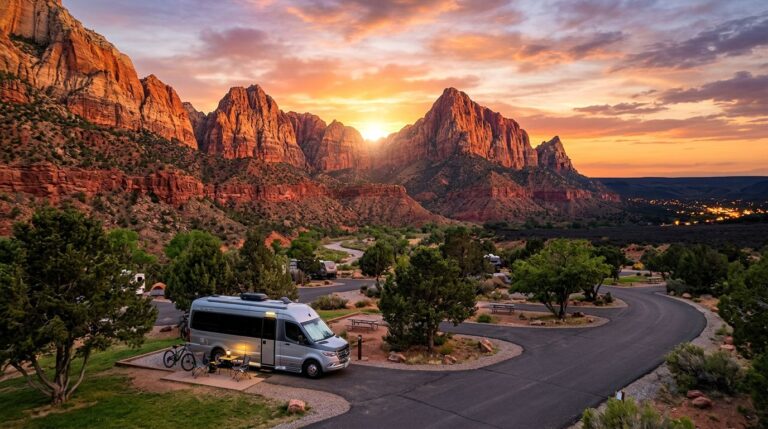
The monument’s developed campground, Bonita Canyon Campground, is currently listed at $25 per night, with reservations through Recreation.gov. Arrival is noon or later, with checkout by 11 a.m.
Backpacking and backcountry camping aren’t allowed inside the monument. The adjacent Chiricahua Wilderness in Coronado National Forest offers multi-day backpacking possibilities under separate forest rules.
Don’t plan to sleep at the Sugarloaf lookout or beside a monument trail.
My Pick for Your First Visit
Start with the counterclockwise Echo Canyon route if you’re comfortable with moderate hiking. Choose Massai Point if time, weather, or fitness calls for something shorter.
The strongest first-day plan leaves room to enjoy the rocks, rather than squeezing in every trail. Save Heart of Rocks for a day when you’ve got the water, daylight, and energy to give it proper attention.
Frequently Asked Questions
What’s the easiest Chiricahua hike with big views?
Massai Point Nature Trail is the best easy option for broad views of the formations. Its half-mile loop takes roughly 30 minutes at a casual pace. Bonita Creek and Silver Spur Meadow are shorter, but offer a different setting.
Can beginners hike Heart of Rocks?
Fit beginners can, as long as they’re comfortable with roughly 7.4 miles and substantial climbing. The 1.1-mile figure describes only the inner loop. If you’re unsure about your endurance, choose Echo Canyon first.
Is Chiricahua worth visiting without a long hike?
Absolutely. Bonita Canyon Drive, Massai Point, and the shorter nature trails make a rewarding visit without a strenuous outing. You can see the volcanic rock formations, enjoy the overlooks, and still keep your walking modest.