Pinnacle Overlook is my first pick for a short walk with a big view, while Sand Cave and White Rocks deserve a full hiking day. The best Cumberland Gap hikes depend on how much climbing you want, and where you start.
Cumberland Gap National Historical Park spans Kentucky, Virginia, and Tennessee, with wooded trails, historic routes, and dramatic overlooks.
Your starting point matters here: a quick overlook walk and a strenuous uphill approach can lead to the same destination.
Key Takeaways
- Drive to Pinnacle Overlook for the easiest mountain panorama, at an elevation of 2,440 feet.
- Take the moderate 2.4-mile round trip from Thomas Walker to the three-state boundary.
- Save Sand Cave and White Rocks for a full day with plenty of daylight.
- Treat the full Ridge Trail as a backpacking route, with transportation arranged at both ends.
Cumberland Gap Hikes at a Glance
The park offers about 85 miles of hiking routes. That’s plenty of choice, but the mileage needs a little interpretation.
The NPS hiking descriptions distinguish individual trail segments from the approaches needed to reach them. Keep that distinction in mind when choosing your route.
The stated miles describe different access points, not interchangeable versions of the same hike.
| Route | Distance | Difficulty | Planning time | Main payoff |
|---|---|---|---|---|
| Pinnacle parking-area walk | About 150 to 200 yards each way | Easy | Allow 20 to 30 minutes with views | Three-state panorama |
| Pinnacle Trail from McCook | 0.8 mile one way | Strenuous | Depends on connecting route | Uphill overlook approach |
| Tri-State Peak from Thomas Walker | 2.4 miles round trip | Moderate | Allow 1.5 to 2 hours | Three-state marker |
| Wilderness Road Trail | 2.4 miles one way | Easy to moderate, with harder sections | About 1.5 hours one way | Historic mountain passage |
| Sand Cave and White Rocks access | Ewing Trail is 2.5 miles one way, plus connecting routes | Very challenging | Reserve most of the day | Rock shelter and cliff views |
| Ridge Trail | About 19 to 21 miles one way | Strenuous | Typically 1 to 3 days | Extended ridge travel |
For beginners, I’d start with Pinnacle or a shorter option. More miles bring more climbing, route decisions, and responsibility for getting back.
Pinnacle Overlook: Big Views Without a Long Hike
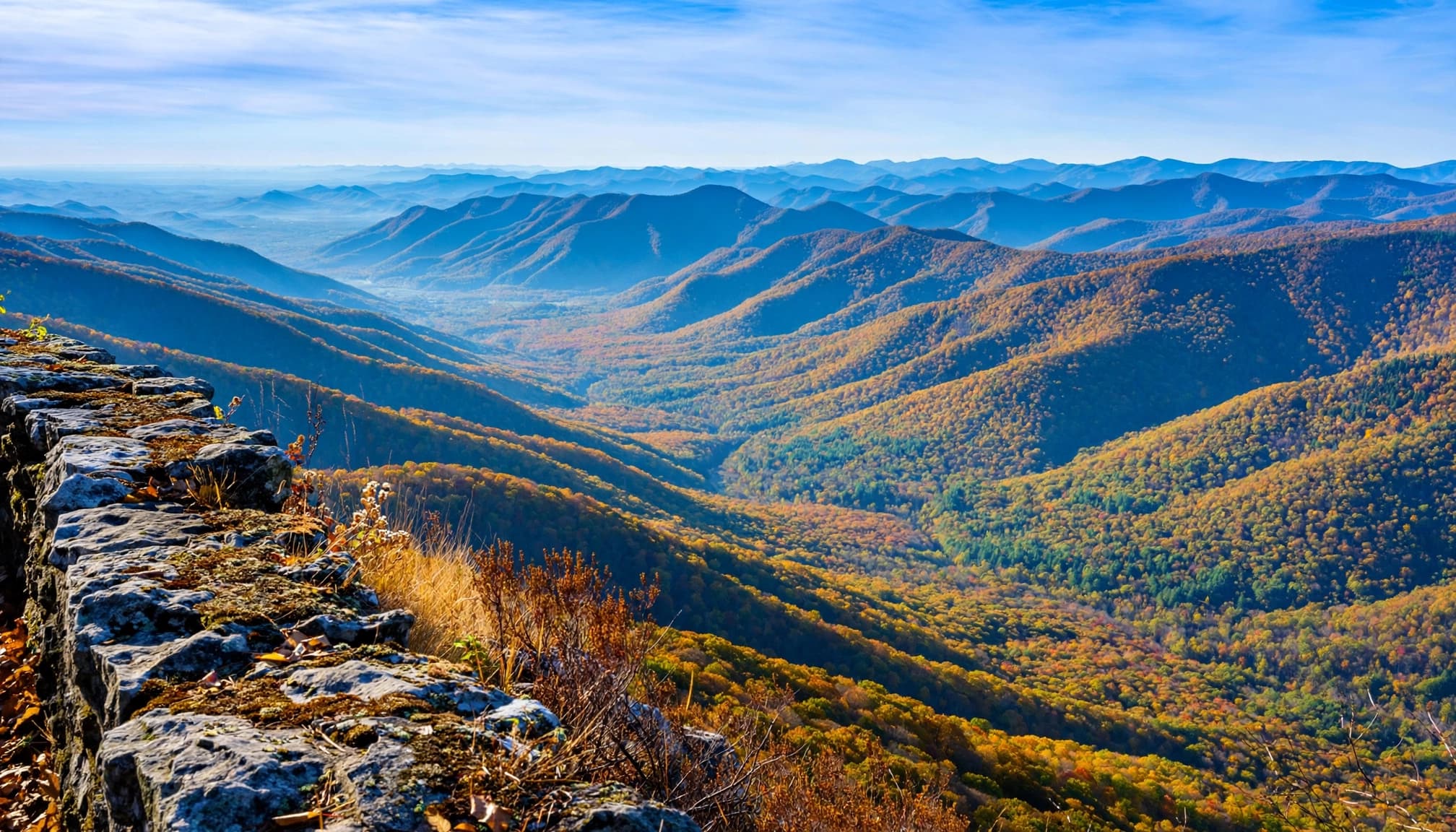
The short walk from the upper parking area
Pinnacle Overlook sits at 2,440 feet, with views across Kentucky, Virginia, and Tennessee. If your priority is scenery rather than a workout, drive to the upper parking area and take the short paved approach.
NPS descriptions give slightly different measurements for this walk, roughly 150 to 200 yards each way. Either way, you’re looking at a brief outing rather than a mountain climb.
I recommend this option for mixed-ability groups and families with young children. Give yourself time at the overlook instead of treating it as a stop to rush through.
Keep children close near the viewing edge. A paved approach doesn’t remove the need for care around an overlook.
The uphill approach is a different outing
The Pinnacle Trail from McCook Parking Area is listed at 0.8 mile one way and rated strenuous. Connecting trails can add distance.
That explains why Pinnacle mileage can look confusing: some descriptions measure the final parking-area walk, while others include a climb from below. The starting location changes the effort.
The NPS overlook descriptions separate these access options.
The overlook’s elevation isn’t your elevation gain. Driving to the upper lot removes most of the climbing required by a lower trailhead approach.
Choose the uphill route because you want the climb. For a quick visit, the upper parking area is the practical choice.
Hikes With History Along the Way
Tri-State Peak: Stand in three states
Tri-State Peak is my recommendation when you want a manageable hike with a memorable finish. The marker identifies where Kentucky, Virginia, and Tennessee meet.
From Thomas Walker Parking Area, allow 2.4 miles round trip. The signed summit spur is only 0.6 mile one way, but reaching it requires an approach.
Follow the route through the historic gap to the signed junction, then continue uphill to the marker. Return along your approach.
Expect a moderate climb and uneven footing. This is a better choice for children comfortable walking uphill than for a stroller outing.
Keep in mind, though, the boundary marker is the main reward. Choose Pinnacle if a broad mountain panorama matters more than standing at the three-state meeting point.
Wilderness Road: Choose your turnaround
Wilderness Road Trail offers a quieter, history-focused walk through the gap. NPS lists it at 2.4 miles one way, with about 1.5 hours of walking in each direction.
Walking the whole route and returning the same way means roughly a 4.8-mile outing. That distinction matters if you’re planning a relaxed family visit.
The route is generally easy to moderate, but it includes harder sections. Don’t assume the entire historic corridor is flat or equally comfortable.
For beginners, I recommend a shorter out-and-back. Decide how much walking your group wants, enjoy the wooded passage, and turn around with energy left.
This route is a good fit when you want the gap’s history and forest setting rather than another overlook. Pair a short section with Pinnacle for a varied half-day visit.
Sand Cave and White Rocks: Save a Full Day
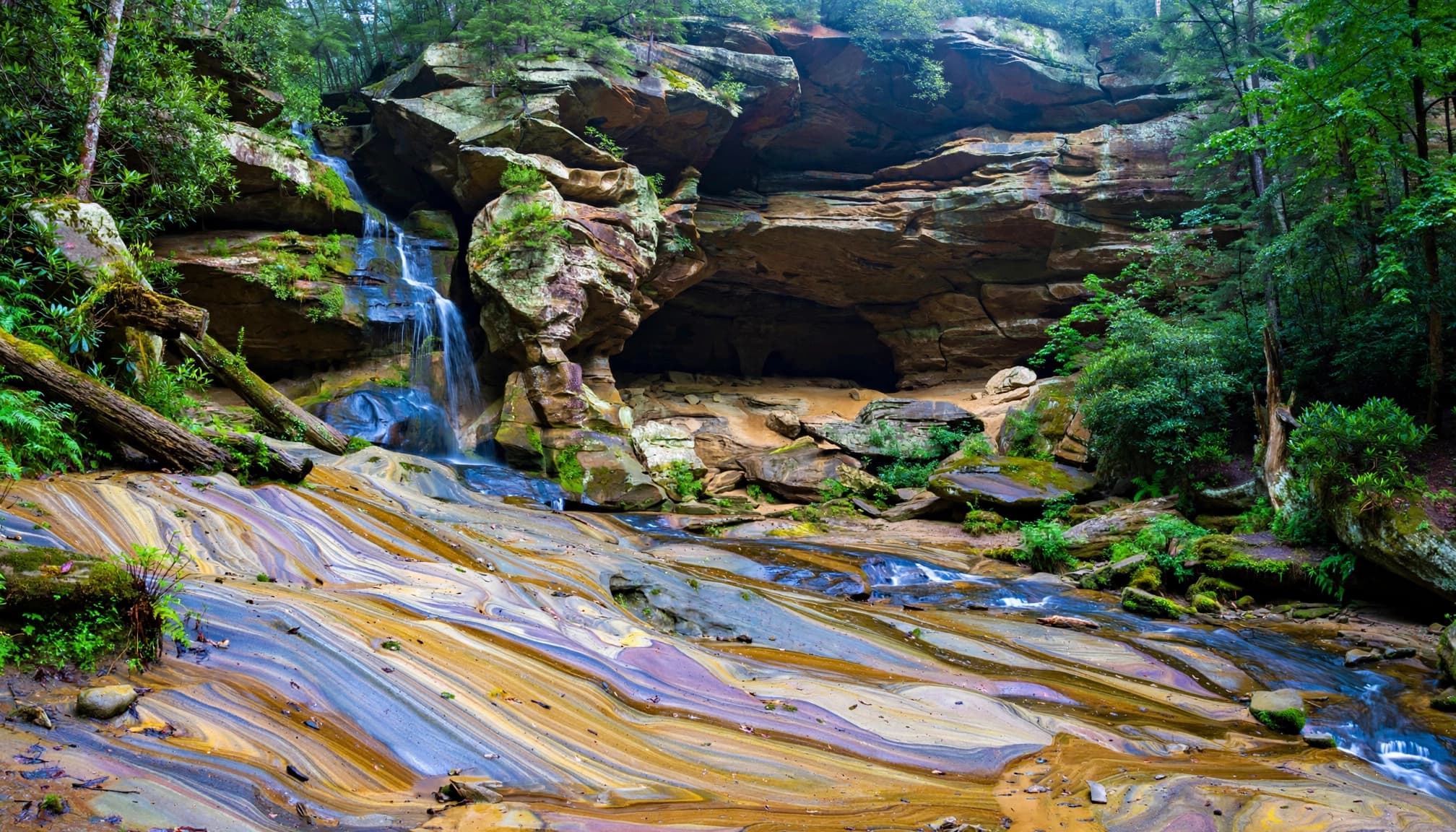
Start at Civic Park for the strenuous climb
These eastern routes make for the most strenuous day among Cumberland Gap hikes, especially with White Rocks on the itinerary. Start at Civic Park near Ewing, Virginia, and climb the Ewing Trail toward the ridge.
NPS lists Ewing Trail at 2.5 miles one way, with about two hours for the uphill section. Reaching both destinations requires extra ridge and side-route mileage.
I wouldn’t plan this day around the Ewing mileage alone. Download the complete route, identify the junctions for both destinations, and account for every connector on the trail.
The cave is a large rock shelter with fine, colorful sand. A waterfall may appear after good rain, so don’t count on flowing water during a dry spell.
Give yourself time to enjoy the shelter without disturbing the sand or climbing fragile rock features.
White Rocks adds views and more effort
The open overlook gives you a dramatic view of the countryside below, but the terrain needs more care than a roadside viewpoint.
Wear shoes with grip, move carefully on uneven rock, and stay well back from exposed edges. After rain, the footing can be slippery.
I recommend starting early and carrying lunch, extra water, and a headlamp. Reserve most of the day so breaks and junction decisions don’t become a race against sunset.
For beginners, this is a substantial step up from Tri-State Peak. Build confidence on shorter climbs first.
Reaching the ridge doesn’t finish the work. You’ll still need enough energy and steady footing for the descent to Civic Park on the trail.
Ridge Trail: Plan for More Than a Day Hike
It runs between Pinnacle Overlook at the western end and White Rocks at the eastern end. NPS descriptions place it at approximately 19 to 21 miles one way.
The listed duration is typically one to three days. For this article’s beginner audience, I’d treat the full traverse as a backpacking objective.
Before committing, arrange transportation between your endpoints and plan overnight stops around the park’s backcountry camping requirements. A one-way distance doesn’t include getting back to your car.
You also shouldn’t expect uninterrupted overlook scenery. The ridge includes long wooded stretches between openings, with repeated climbs and descents.
Want a smaller taste? Choose a mapped out-and-back section with a firm turnaround point. Keep the return distance visible in your plan.
Carry both an offline map and a paper backup for longer outings. At junctions, match the trail name to your intended route rather than following whichever path looks most traveled.
Fog can hide the surrounding terrain surprisingly quickly. Clear skies at the trailhead aren’t a reason to leave navigation tools behind.
Practical Planning for Your Hiking Day
Visitor Center, admission, and camping
Start at the Visitor Center in Middlesboro, Kentucky. The park lists 91 Bartlett Park Rd., Middlesboro, KY 40965, as its mailing address; the visitor information number is 606-248-2817.
Park admission is free. Guided tours and camping cost extra.
Wilderness Road Campground is in Virginia, about three miles from the Visitor Center. Camping is available year-round, although weather and seasonal loop closures can limit availability.
Check official NPS park alerts and current trail, road-access, and campground conditions for closures before setting out. Schedules and access can change.
Keep your day geographically sensible. Pinnacle, Tri-State Peak, and the historic gap fit a western-end visit. The Civic Park approach belongs to a separate eastern-end hiking plan.
I wouldn’t squeeze Sand Cave into an afternoon after touring the western sights. Give that climb its own day.
Weather, footwear, and what to carry
Spring and fall are appealing hiking seasons, but wet leaves, muddy sections, and slick rock still demand attention. Summer adds heat and humidity; winter can bring ice.
Carry water, snacks, rain protection, and a warm layer. Longer routes also deserve a headlamp and basic first-aid supplies.
Comfortable footwear matters more than buying the heaviest boot available. My guide to hiking boots for rocky trails compares options if you need better grip and support.
Download your map before arriving, since cell service may be unreliable. For a first visit, choose one substantial hike and leave room for stops.
A shorter route enjoyed at your own pace beats a longer itinerary that has everyone watching the clock.
Hensley Settlement and Gap Cave Tours
Hensley Settlement tours are a useful history-focused addition, but they need advance planning. The current listed schedule runs from mid-May through October, with tours lasting about four hours and costing $10 per adult.
Reservations open up to one month ahead and must be made by noon the day before the tour. Use the park’s visitor information number to arrange your place.
Gap Cave ranger tours operate seasonally, with the current listed tour window running May through August. Allow about two hours.
The tour covers a 1.5-mile total hike and includes 183 stair steps. That mileage describes the total tour route, rather than 1.5 miles entirely inside the cave.
The current listed adult ticket price is $8; tickets for children ages 5 to 12 cost $4. I’d avoid stacking either tour onto an already ambitious hiking schedule.
Cumberland Gap Hiking FAQs
Are dogs allowed on Cumberland Gap trails?
Yes. Dogs may use park trails on a leash no longer than six feet. Keep them close around other hikers and away from exposed overlook edges.
Which route is best for young children or a stroller?
The paved approach from Pinnacle’s upper parking area is the most practical starting point for a short walk to the overlook. Tri-State Peak and the longer forest routes have uneven terrain. For more manageable outings elsewhere, browse my beginner-friendly hiking picks.
Can I visit Sand Cave without White Rocks?
Yes. They are separate destinations reached through the connecting trail network. Leaving out White Rocks reduces your itinerary, but the Ewing Trail approach remains demanding.
Can I drive to Pinnacle instead of hiking uphill?
Yes. Road access to the upper parking area lets you take the short paved walk. The Pinnacle Trail is a separate option for hikers who want an uphill approach.
Choose the View That Fits Your Day
For a first visit to Cumberland Gap, I’d pair Pinnacle’s easy panorama with Tri-State Peak or a shorter Wilderness Road walk. That gives you mountain scenery and a worthwhile hike without overloading the day.
Save the longer eastern hikes, including White Rocks, and the full ridge traverse for the time and preparation they deserve.
The right hike starts with an honest choice about distance, climbing, and how much daylight you have.