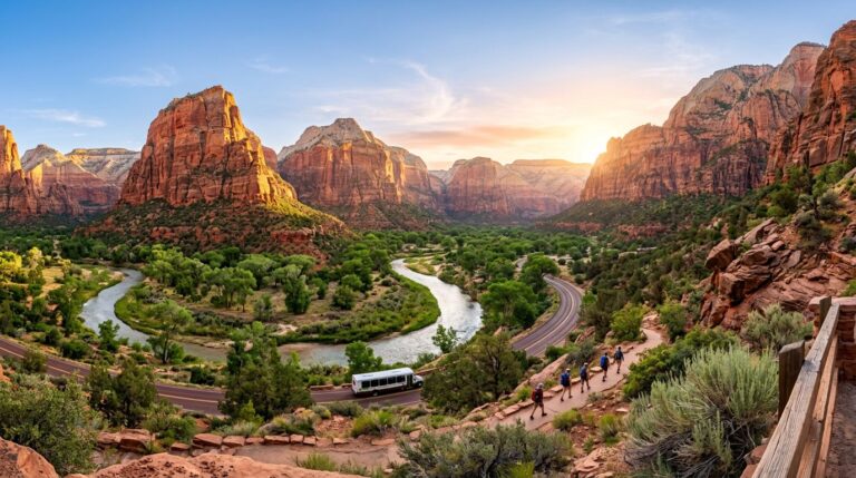
Most first-time visitors make the same mistake in Joshua Tree National Park: they try to cover the whole park in one sweep. The Joshua Tree map looks simple on paper, but it feels much bigger once you are driving, parking, and hiking in Mojave Desert heat.
The short answer is to start in the west-central part of the park, around Hidden Valley, Cap Rock, Barker Dam, and Keys View. That cluster gives beginners the best scenery, the easiest navigation, and the highest payoff per stop.
Key takeaways:
- Hidden Valley is the best first stop because it gives you classic Joshua Tree scenery fast.
- Keys View adds the big-picture overlook that helps the whole map make sense.
- With more time, choose either Jumbo Rocks and Skull Rock or the Cottonwood area in the south, not both.
- There is no gas, food, or reliable water inside the park, so fill up in the gateway towns before you enter.
Before you go: how Joshua Tree is laid out
Two desert ecosystems meet inside the park, and that geography explains the whole map. The higher, cooler Mojave Desert covers the north and west, and it is where the Joshua trees grow. The lower, hotter Colorado Desert sits to the south, with creosote flats, ocotillo, and cholla instead of Joshua trees. Most first-timer highlights sit on the Mojave side.
The park has three entrances. The West Entrance near the town of Joshua Tree is the busiest and the closest to the west-central highlights. The North Entrance near Twentynine Palms sits near the main visitor center and park headquarters. The South Entrance at Cottonwood comes off Interstate 10 and has the fewest Joshua trees. No reservation is needed to enter, and the park is open 24 hours a day, year-round. The entrance fee is $30 per vehicle and covers seven days.
A few logistics matter more here than in most parks. There are no gas stations, restaurants, or grocery stores inside Joshua Tree, and there is no water in the interior, so carry everything you need and fuel up in a gateway town first. Cell service is very limited, so download maps before you arrive. The best season runs from October through May. Summer days regularly top 100°F and can be dangerous, so plan hikes for early morning in the warmer months. Joshua Tree is also a designated dark-sky park, which makes it a popular place to stay for stargazing.
For a stop-by-stop plan that fits one day, see this Joshua Tree one-day itinerary. To download the official map, grab the park brochure PDF from the National Park Service and skim the first-time visitor guide. The National Geographic Trails Illustrated map adds more trail detail for anyone who wants it.
How to break down the Joshua Tree map
The simplest way to plan a first visit is to split the park into three practical zones, not a dozen pins. The west-central core is the clear winner for most beginners. Add one second zone only if time, energy, and daylight still look good.
This quick comparison shows how to prioritize the main areas:
| Area | Why start here | Best for |
|---|---|---|
| Hidden Valley and Cap Rock | Short drives, iconic Mojave Desert rocks, easy trails | First-timers |
| Keys View | Huge overlook that helps you understand the park layout | Scenic stop |
| Jumbo Rocks and Skull Rock | Fun roadside boulders, easy add-on | Families, casual walkers |
| Cottonwood | Quieter, more spread out, different Colorado Desert feel | Second-day visit |
The takeaway is simple. Start compact. A tighter route usually beats a longer one in Joshua Tree, because parking, sun, and drive time add up fast.
Start with Hidden Valley, then work outward
If you want one place to begin, go straight to Hidden Valley. This is the part of Joshua Tree National Park that looks like the postcards came to life: giant boulders that draw rock climbers, twisted trees, open desert, and trails that do not demand a heroic effort.
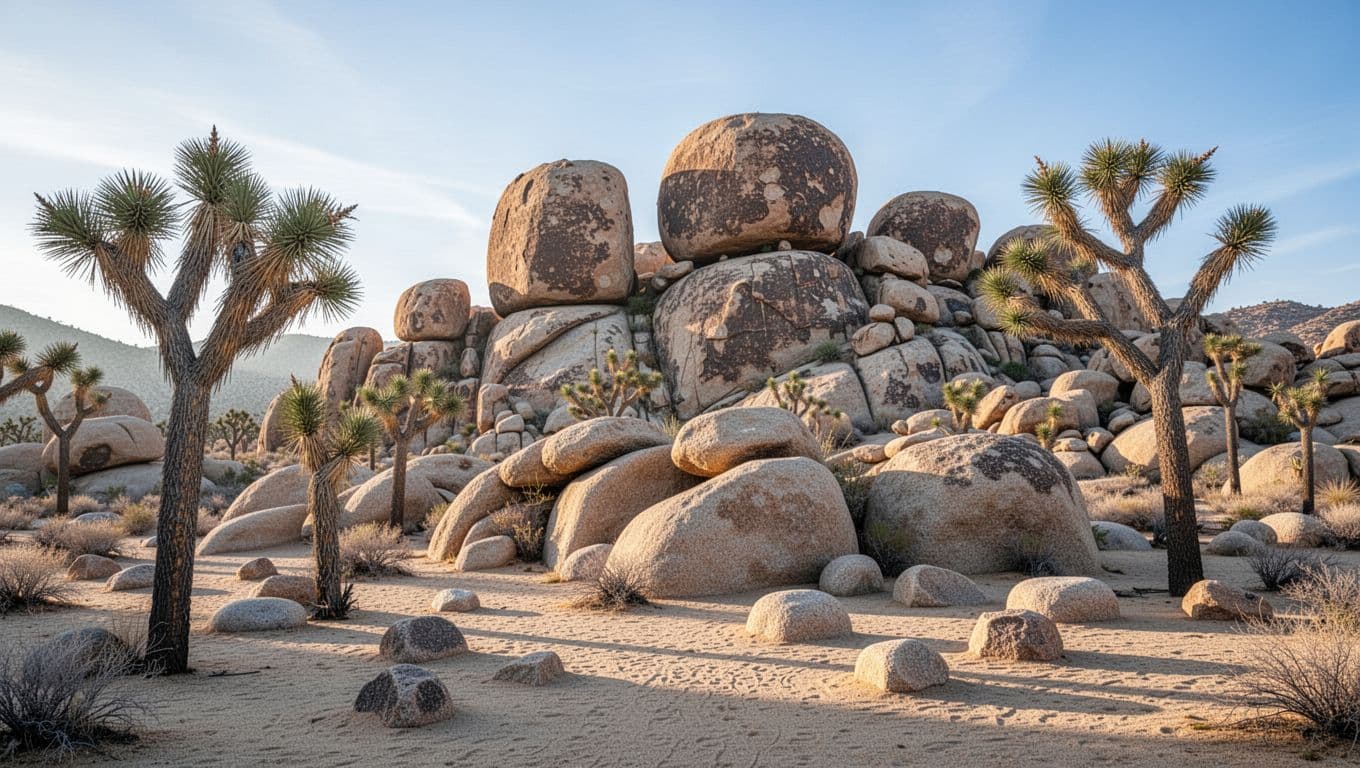
The Hidden Valley Nature Trail is the best place to warm up. The loop runs about a mile, it is easy to follow, and it is visually dense, so you get the park’s signature look without spending half the morning in the car. After that, Cap Rock is an easy second stop, especially if you want a shorter walk or softer light late in the day.
With only a half-day in Joshua Tree, the west-central zone is enough on its own. There is no need to overthink it.
Barker Dam fits well here too, though it works better as a bonus stop than the main event. Some people hear “dam” and expect a dramatic water hike, but that is not the point. The roughly 1.3-mile loop is worth it for the boulders, the change of scenery, and the chance to watch for desert tortoise.
This area also makes route-finding easy. You are not bouncing between far corners of the map. You can park along Park Boulevard, walk, drive a few minutes, and do it again. For beginners, that rhythm keeps the day fun instead of rushed.
Use Keys View to read the park fast
After Hidden Valley, head to Keys View. This is the stop that makes the rest of the Joshua Tree map click. Perched on the crest of the Little San Bernardino Mountains, the overlook is a 20-minute drive down Keys View Road from Park Boulevard. From the top you can see across the Coachella Valley, trace the San Andreas Fault running through the valley below, and pick out the shining surface of the Salton Sea on a clear day. The park suddenly feels less random.
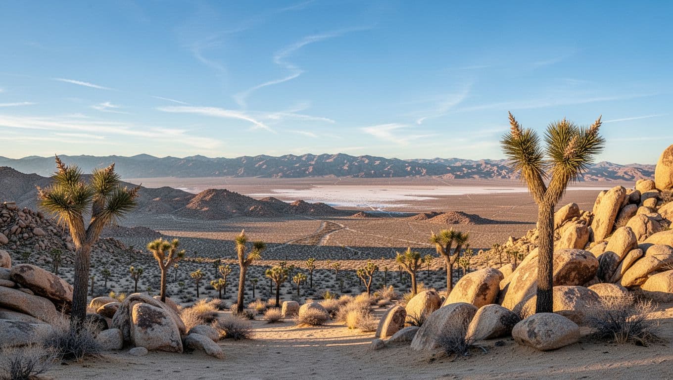
Keys View is best in the later afternoon, when the light softens and the view gains depth. A short 0.2-mile loop trail climbs the ridge for an even wider panorama. Wind or haze can flatten the scene, though, so it is worth checking conditions rather than forcing the timing.
From here, most first-timers pick one of two moves. For more classic boulder scenery with minimal effort, drive toward Jumbo Rocks and Skull Rock, where the views start before your shoes even hit the ground. For a quieter finish, save your energy for the Cottonwood area in the south instead.
A little restraint helps here. People see a pin for every named stop and assume they should hit them all. One overlook, one or two short trails, and one easy roadside wander is usually the sweet spot.
Save Cottonwood for a quieter second area
Cottonwood is the area to add when you want space and a different feel. It sits in the park’s southern section, in the Colorado Desert, so it does not pair as neatly with Hidden Valley on a short day. To reach it, drive down Pinto Basin Road toward the South Entrance. With extra time, it offers a calmer side of Joshua Tree that many first-timers miss.
The Cottonwood Visitor Center makes a useful anchor, with easier orientation, a softer pace than the busy west side, and one of the few places in the park to refill a water bottle. The southern drive also passes the Cholla Cactus Garden, a flat quarter-mile loop through thousands of teddybear cholla, about 12 miles south of the North Entrance. For hikers with more time, Lost Palms Oasis makes a rewarding longer trail from the Cottonwood area.
Conditions in the desert change with weather, flooding, and seasonal closures, and trails or roads can close on short notice. Check the National Park Service current conditions page before locking in any single stop, especially anything in the south or any spur trail to an oasis.
If you are pairing this trip with other desert parks, the guide to the best hikes in California by season can help you choose the right month, and the Death Valley National Park map works the same way for a nearby first visit. For trips that cross the state line, the best hikes in Arizona cover heat-smart desert options too. To sketch a route across several parks, try the free national park trip planner.
The map looks far less overwhelming once you stop treating every named stop as a must-do. Begin in the west-central core, add Keys View, then choose one second zone. That plan saves time and still feels full. For most beginners, the best first trip is the one that leaves a little unfinished, because Joshua Tree is better when you still have a reason to come back.
FAQs
What part of Joshua Tree should I visit first?
Start near Hidden Valley and Cap Rock in the west-central part of the park. That area gives you Joshua Tree’s classic scenery with short drives and simple trail choices.
Which entrance is best for first-timers?
The West Entrance near the town of Joshua Tree is usually the easiest for a highlights-focused day, since it is closest to the west-central core. The North Entrance near Twentynine Palms sits near the main visitor center and works well as a backup. The South Entrance at Cottonwood, off Interstate 10, is better suited to a quieter second visit.
Can I enjoy Joshua Tree without long hikes?
Yes. Hidden Valley, Keys View, Skull Rock, and Cap Rock all work well for beginners who want short walks and big views.
Is there gas, food, or water inside the park?
No. Joshua Tree has no gas stations, restaurants, or grocery stores, and there is no water in the park interior. Fuel up, buy food, and fill water bottles in a gateway town such as Joshua Tree or Twentynine Palms before you enter.