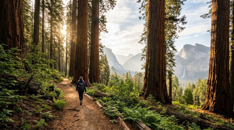
For your first Katahdin hike, I’d plan around a full mountain day and leave the Knife Edge optional. Your route choice matters more than getting the famous ridge photo.
Baxter State Park rewards careful planning, but parking reservations, exposed terrain, and changing weather can complicate your summit day. You can reach Baxter Peak without crossing the Knife Edge and still have a breathtaking climb.
Start with the demands of the mountain, then let route preparation guide your reservations and gear for a route you can handle.
Key Takeaways
- Allow a full day for the climb, and choose your route based on scrambling experience as well as fitness.
- Reserve the correct trailhead parking space, arrange camping separately, and check current access before leaving home.
- Treat the Knife Edge as an optional route for suitable conditions and experienced hikers, rather than a required part of summiting Katahdin.
Know What a Katahdin Hike Demands
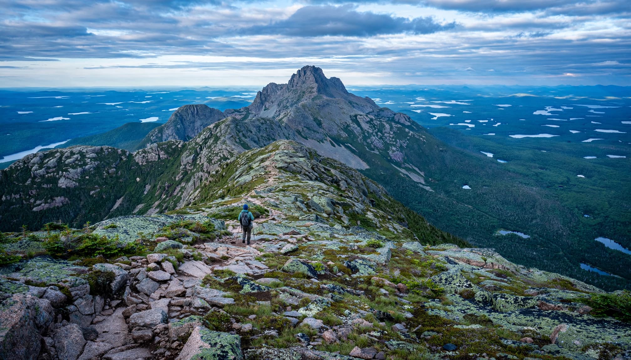
At 5,267 feet, Baxter Peak on Mount Katahdin marks the northern terminus of the Appalachian Trail. That summit sign is famous for good reason, but getting there takes more than enthusiasm.
Plan for a long day in rough terrain
Baxter State Park’s hiking information puts the average round trip at 8 to 12 hours, with roughly 4,000 feet of elevation gain. Treat these as planning estimates, since conditions and your pace can change.
The summit hike is a substantial day before you add breaks, slower scrambling, or route-finding in poor visibility. Above the tree-line, exposure and rough footing can add to the effort. Don’t estimate your finish time using your pace on smooth woodland trails.
The descent deserves its own energy budget. Stepping down large rocks with tired legs can feel harder than the climb, especially when your knees start complaining. Leave room in your schedule for that slower return.
Train for more than uphill endurance
Running helps your lungs. Rocky hiking also asks for balance, controlled downhill steps, and confidence using your hands.
Before attempting Katahdin, build up through longer hikes with elevation gain and rough footing. Practice with the pack and shoes you’ll use on summit day.
If you’re still finding your trail legs, start with these beginner-friendly Maine hiking trails. Ocean Path and Great Head offer easier introductions; Old Speck or Tumbledown can be later steps toward a bigger mountain day.
Choose Your Summit Route Before Booking
There isn’t an easy route to Baxter Peak. There are, however, meaningful differences in exposure, scrambling, and where you’ll finish.
Match the trail to your experience
These are the main approaches worth comparing.
| Route | Starting area | Main consideration |
|---|---|---|
| Hunt Trail | Katahdin Stream | Long, strenuous approach with exposed bouldering and scrambling |
| Abol Trail | Abol Campground | Steep ascent over rocky slide terrain |
| Saddle Trail | Roaring Brook, via Chimney Pond | Strenuous summit option that avoids the Knife Edge |
| Helon Taylor and Knife Edge | Roaring Brook | Pamola Peak approach followed by an exposed ridge traverse |
The Appalachian Trail Conservancy’s Katahdin guide lists Hunt at 5.2 miles each way, or 10.4 miles round trip. The park’s online descriptions differ on Hunt and Abol distances, so confirm your route against the current park map.
Compare trail difficulty and terrain before mileage. Your hiking experience and physical fitness should guide your choice. A shorter route through rugged terrain can demand more effort than a longer trail with steadier footing.
Make sure the route returns to your vehicle
For a Knife Edge outing, plan around the Roaring Brook side. Helon Taylor reaches Pamola Peak, and the Knife Edge connects Pamola with Baxter Peak.
Choose your descent before starting, too. A traverse beginning at Hunt or Abol and ending at Roaring Brook leaves you far from your car.
The road journey between those sides takes about an hour, and the park provides no shuttle. Arrange transportation beforehand or choose a route that finishes at your starting trailhead.
Reserve Parking and Camping Separately
Book access once you’ve chosen your route. A reservation at the wrong trailhead won’t help when your intended climb starts elsewhere.
Understand the Katahdin Trailhead Pass
The Katahdin Trailhead Pass (KTP) reserves parking, not summit access, and isn’t a day hiking permit. Check current park access rules before your trip.
The Katahdin trailhead parking reservation page has current fees, reservation dates, and monthly limits. Check it before booking, since details can change.
KTPs aren’t required in May, but that doesn’t guarantee summit trails are open. Snow, mud, and seasonal conditions still control access.
For a planned day hike, I’d reserve parking rather than build a long drive around uncertain availability. Check your confirmation and current reservation information for arrival requirements.
Choose a base that keeps the morning simple
Millinocket is a practical base outside the park. Staying closer to your trailhead can simplify an early start, as long as you’ve secured the appropriate campsite.
Keep camping reservations separate from day-use parking reservations. Check what your campsite booking provides rather than assuming it includes parking at another trailhead.
Allow time for the drive through the park, too. These are remote park roads, and your trip doesn’t begin the moment you reach the entrance.
Before leaving home, confirm your campsite, trailhead, route, and current access rules together.
Decide Whether the Knife Edge Fits Your Trip
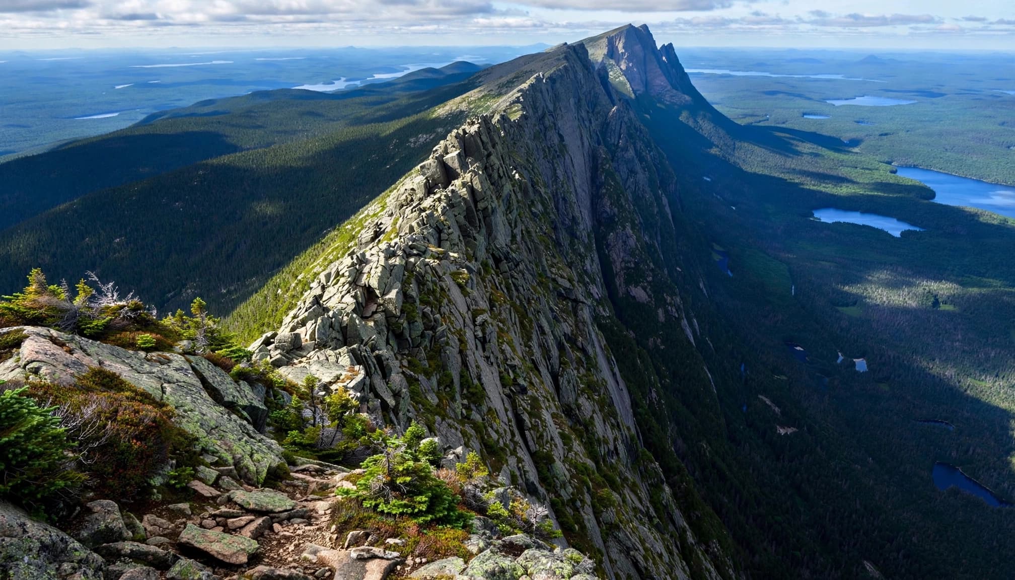
Park maps call it Knife Edge, though some hikers know it as the Knife’s Edge. The route from Pamola Peak is completely exposed above tree-line, with steep drops and sections that require careful scrambling. Park guidance estimates roughly 1 to 1.5 hours for the one-way crossing.
That time belongs in your overall route budget. It isn’t a quick scenic detour.
I wouldn’t choose it as a first introduction to exposed scrambling. Strong fitness doesn’t tell you how you’ll react when the footing narrows and the ground falls away.
Wet rock, high winds, ice, poor visibility, and severe weather make this terrain much less forgiving. The park warns that people have died or suffered serious injuries here during bad weather and high winds.
Once you’re on the Knife Edge, don’t descend off the ridge to escape weather or bypass a difficult section. The steep sides aren’t bailout routes.
On suitable terrain, move deliberately and keep three points of contact during scrambling. Stow trekking poles when you need your hands, and leave space between hikers.
Don’t let faster people rush you through a move that feels uncertain. If the approach already exceeds your comfort level, reconsider the crossing before committing.
There’s no water on the Knife Edge. Carry what you’ll need and keep the ridge optional, even when it’s the part you’re most excited about.
Pack for a Full Mountain Day
The basics that work on short Maine hikes still matter here. Katahdin calls for extra protection from cold, wind, delays, and rough terrain.
A practical pack for summit day should include:
- Carry sufficient water for your route, a proper lunch, and snacks you’ll eat throughout the day.
- Pack a waterproof shell, an insulating layer, and weather-appropriate headwear, even when the parking lot feels warm. Conditions above the tree-line can be colder and windier.
- Bring a headlamp, first-aid supplies, an emergency shelter, and sun protection.
- Download an offline map, carry a paper backup and compass, and bring a charged phone with backup power.
Wear hiking shoes or trail runners with dependable grip. Choose footwear you’ve already tested on rocky hikes, rather than breaking in new boots here.
Trekking poles can help on the approach and descent, but they need to pack away securely for scrambling. Loose poles swinging beside your legs are a nuisance on steep rock.
Keep important layers accessible. You don’t want to unpack everything while standing in cold wind above the trees.
Build a Conservative Summit-Day Plan
Start with the forecast and current trail status, then check in with park staff when you arrive. Weather conditions can change, and a parking reservation doesn’t guarantee suitable hiking conditions.
Before summit day, confirm:
- Current trail status and official park guidance
- Your reservation and access details
- The forecast
- Your route and turnaround plan
- Essential supplies
Set your turnaround plan before climbing
Choose a turnaround time based on your route, daylight, group pace, and the day’s conditions. Follow current ranger instructions and take basic safety precautions.
Tell someone outside your group where you’re hiking and when you expect to return. Keep the group together instead of sending slower hikers down alone.
Reassess at major junctions and before exposed terrain. If you’re moving much slower than expected, change the plan while you still have good options.
The summit will still be there. A manageable descent matters more than squeezing in the final climb.
Respond early when the weather changes
Check a mountain forecast, not only the forecast for Millinocket. Wind and temperatures above the tree-line can feel very different from conditions in town.
If thunderheads build, visibility drops, or gusts affect your balance, reassess before entering exposed terrain above the tree-line. Don’t wait for rain to prove the situation is worsening.
If thunder threatens while you’re still below exposed terrain, abandon the summit plan. When already high, return along your established route toward lower terrain when you can safely do so.
Stay on marked trails. Fog is a poor time to improvise a shortcut across unfamiliar rock.
Frequently Asked Questions
Do I have to hike the 100 Mile Wilderness first?
No. The 100 Mile Wilderness is part of the Appalachian Trail approach, but a Katahdin day hike starts inside Baxter State Park. Choose a trailhead and plan your summit route separately.
Can I bring my dog to Baxter State Park?
No. The park prohibits pets and other domestic animals. Check Baxter State Park’s rules and permits before traveling, and arrange care for your pet outside the park.
When should beginners plan their hike?
Summer and early fall are general planning windows for a non-winter hike, but trail openings and conditions can change. Choose a suitable weather window rather than fixing your plan around a summit date. Snow, ice, wind, or closures may require a change of plans.
Make the Safe Return Part of the Goal
A well-planned Katahdin hike starts with an honest route choice and leaves enough energy for the descent. Parking, gear, and an early start support that decision.
I’d keep the Knife Edge optional and make the safe return more important than reaching the mountain summit. Reaching Baxter Peak is wonderful, as long as your plan also gets you safely back to the trailhead.