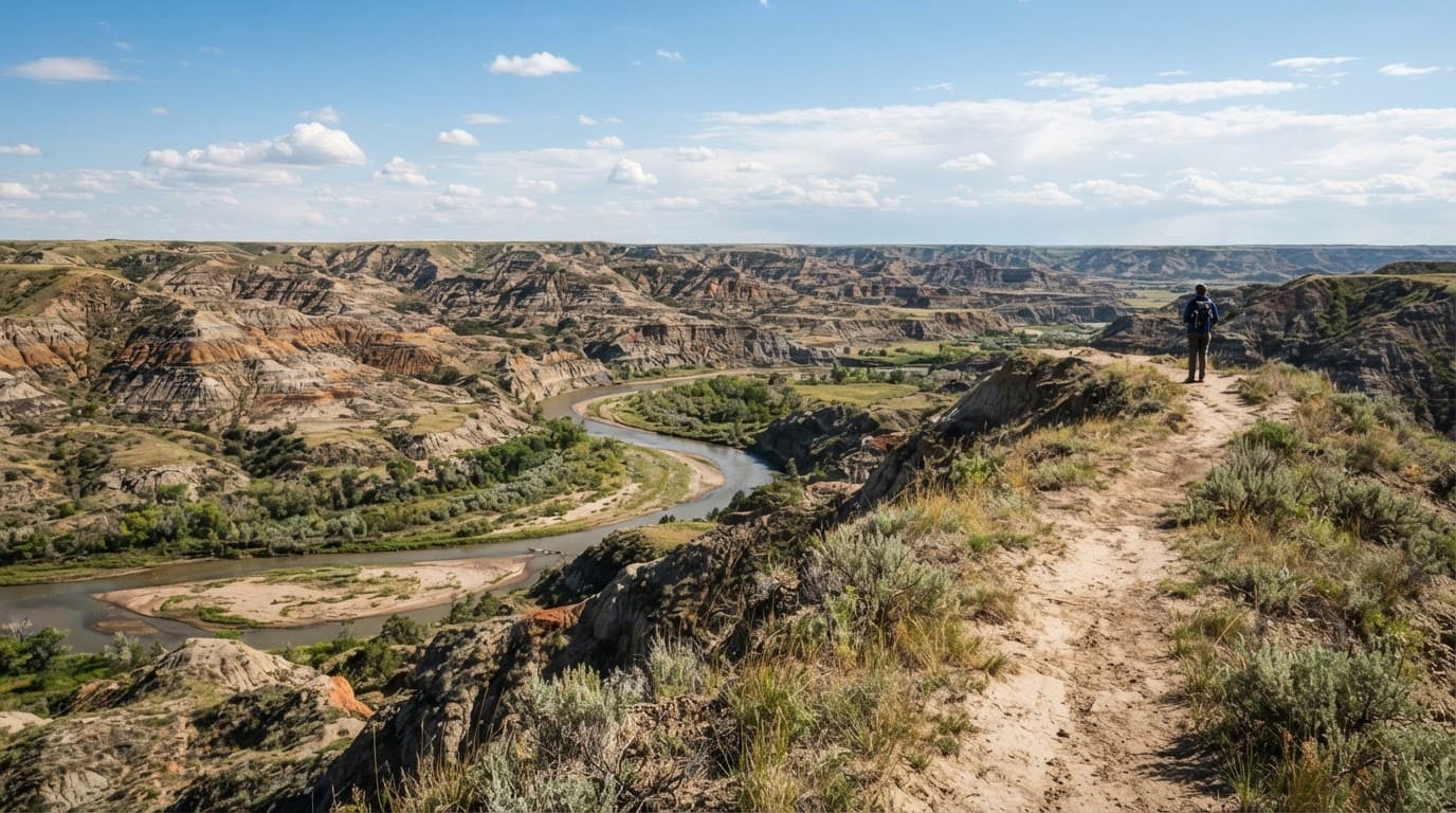
North Dakota looks flat right up until the ground falls away. Then you are standing above the Little Missouri River, watching it curve through striped clay formations and wide-open prairie with almost nobody else around.
The best hikes in North Dakota for badlands and river views are not always the longest ones. A short South Unit bluff walk in Theodore Roosevelt National Park can beat an all-day grind if you are visiting for the first time.
Key takeaways:
- The South Unit is the easiest place to start, especially if you are based in Medora.
- The North Unit has the stronger wilderness feel, plus the park’s longest and toughest routes.
- The long-distance route is worth seeing, but most beginners should treat it as a planned day hike, not a casual stroll.
Best Hikes in North Dakota for Badlands and River Views
The Little Missouri landscape is the clear top pick for hiking trails. You get steep clay buttes, grass-covered ridges, a prairie dog town, and river overlooks that feel much bigger than North Dakota gets credit for.
Here are the trails I would narrow down first.
| Hike | Area | Distance | Difficulty | Why It Is Worth Your Time |
|---|---|---|---|---|
| Wind Canyon Trail | South Unit | 0.4 miles round trip | Easy | Fast Little Missouri River views and a great sunset stop |
| Little Mo Trail | North Unit | 0.7-mile paved loop | Easy | A low-stress nature trail with a longer dirt option |
| Caprock Coulee Trail | North Unit | 4.3 miles | Moderate | Clay walls, open prairie, and a bigger sense of space |
| Achenbach Trail | North Unit | 18 miles | Strenuous | A serious backcountry day with steep terrain and remote views |
If you only have a few hours, choose a South Unit stop like Wind Canyon or Little Mo. Both are easy first stops from a marked trailhead. The paved inner loop at Little Mo is an easy nature trail. For a bigger adventure, Caprock Coulee is the sweet spot.
Theodore Roosevelt National Park: South Unit vs. North Unit
Theodore Roosevelt National Park is where many memorable park hikes begin. The park has three separate sections, but the two park units below are where most visitors should plan their time.
Start in the South Unit for easy river views
For a first visit, I’d start in the South Unit. The South Unit’s 36-mile Scenic Loop Drive makes pairing overlooks with short hikes easy. You won’t spend the whole day moving the car around.
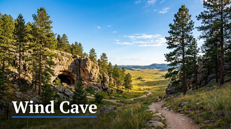
In the South Unit, Wind Canyon Trail is the no-brainer pick. From the trailhead, the roughly 0.4-mile round trip is beginner-friendly. It ends at a bluff above the Little Missouri River. The trail is short, but that view has no business being that good for so little effort. It is also one of the better sunset spots in the park.
If you are building a full South Unit day around Medora, use this Medora day-hike itinerary to plan your stops. It includes a prairie dog town, wildlife viewing areas, overlooks, and smart backup options.
For accessible nature trail options in the South Unit, consider Skyline Vista, Boicourt Trail, and the Painted Canyon Visitor Center overlook. For current distances, difficulty ratings, and trail notices, check the National Park Service’s official hiking trail information before you drive out.
Head north for more solitude and bigger days
The North Unit takes more effort to reach. It rewards hikers who want fewer roads, more empty country, and longer trails. Do not try to squeeze both units into one rushed afternoon. They are separate trips.
Little Mo Trail is an easy nature trail and the beginner option here. Its 0.7-mile inner loop is a paved loop trail. The 1.1-mile outer loop adds unpaved trail and more surrounding landscape. It is a strong choice for families, anyone easing into hiking, or hikers who want a quick walk before driving the scenic road.
Caprock Coulee gives you a bigger badlands experience without committing to an all-day route. The 1.5-mile nature trail works well for a short outing. Continue onto the longer 4.3-mile Caprock Coulee trail if your group wants more climbing and wider views.
Achenbach Trail is a different category. It runs 18 miles and usually takes 10 to 12 hours. There are steep climbs, steep descents, and two river crossings on the Little Missouri. Save this one for experienced hikers with a real plan, a paper map, and enough daylight.
Outside the short marked trails, North Unit routes can require map-and-compass navigation. Downloading a map is smart, but a dead phone should never end your ability to find the trailhead.
The Maah Daah Hey Trail Is Best Sampled in Sections
This headline long-distance route deserves the hype. It crosses badlands country and Little Missouri National Grassland. It also connects the park units on rugged terrain shared by hikers, runners, and mountain bikers.
You may see two different mileage totals. The National Park Service describes a 96-mile route across the National Grassland that connects the park units. North Dakota Tourism describes the broader Maah Daah Hey Trail system. Both figures make sense in their own context, so do not plan your trip around one number you saw on a map.
For day hikers, the move is simple: choose one signed trailhead, set a turnaround time, and treat the day as an out-and-back. Caprock Coulee is a good first taste of the terrain. A short section near a South Unit base can also work well if you are comfortable with exposed trail and changing weather.
Do not expect water, shade, or easy bailouts. Carry more water than you would for the same mileage in a wooded park. The trail association’s segment information is useful when you are sorting out access points, route segments, and current trail planning.
Overnight hikers who enter park backcountry need to handle permits, backcountry camping, and route logistics before starting. This is not the trail to “figure out as you go.”
More North Dakota Trails Worth Adding to Your Trip
The western landscape gets the attention, but it is not your only option. Near Bismarck and Mandan, paved trails along the Missouri River offer easy hiking and biking, with access to Fort Abraham Lincoln State Park. These routes are flatter and more developed, but the river views still deliver.
Cross Ranch State Park is a better choice for Missouri River scenery, cottonwood groves, and a quieter pace. Its level nature trail options work well for families and anyone who prefers firm ground to loose clay.
Little Missouri State Park is the more remote option. Fort Ransom State Park offers a greener setting in the Sheyenne River Valley, with rolling prairie and wooded areas. For either trip, plan food, water, and navigation before leaving town.
Grahams Island State Park adds lake scenery and convenient visitor services near Devils Lake. Turtle River State Park and Lake Metigoshe State Park are better for a change of scenery, with trees and gentler terrain. Lake Metigoshe State Park also suits travelers who want cooler northern air and developed recreation areas. Turtle River has a wooded nature trail, while Icelandic State Park offers a shorter nature trail near lakes and wooded areas.
For a longer eastern route, research the North Country National Scenic Trail separately. It requires more planning than these shorter park walks.
Plan for Sun, Mud, Wildlife, and River Crossings
Summer is a great time to hike in North Dakota, as long as you respect the exposed terrain. There is not much shade on exposed trails. Start early, bring sun protection, and carry plenty of water and salty snacks.
Wear trail runners or hiking shoes with grip. Sneakers can handle a dry, short nature trail, but clay gets slick fast after rain. A route that felt easy in the morning can turn into a muddy mess by lunch.
Keep your distance from bison, prairie dogs, snakes, and any other wildlife. Never step off trail or approach an animal for a photo. Bison can look calm until they decide they are done sharing space.
Crossing the Little Missouri deserves extra caution. If the river is high, fast, or muddy, turn around. Wet feet are annoying. A crossing that pushes you off balance is a real problem when you are miles from the trailhead.
Final Thoughts
The best North Dakota hikes do not need huge mileage to feel memorable. A quiet bluff above the Little Missouri River can give you the same “how is this place real?” feeling as a much longer trail.
Start with a short South Unit walk. Give the South Unit a full day if you can, then explore the northern side when time allows. Save the long-distance route for when you’re ready for a more self-reliant outing. Plan for the conditions, not just the distance.
North Dakota Hikes FAQs
Is summer a good time to hike in North Dakota?
Yes, but morning is the sweet spot. Summer days can be hot and exposed, especially in the South Unit. Hike early, bring more water than usual, and avoid long routes when storms are moving in.
What is the best beginner hike in the park’s northern section?
Little Mo Trail is the easiest place to start. The paved inner loop is only 0.7 miles, and the longer outer loop adds a little dirt trail without turning the outing into a major commitment.
Can I hike part of the Maah Daah Hey Trail for one day?
Absolutely. Pick a starting point, hike out for a set amount of time, then return the same way. Do not underestimate the heat, wind, or lack of water along the route.
What is the best short hike for families?
Wind Canyon Trail in the South Unit is hard to beat. It is short, easy to follow, and ends with a big view over the Little Missouri River.
Are there paved trails near Bismarck and Mandan?
Yes. The communities have riverfront paths that work well for walking and biking. They are a good choice when you want water views without uneven ground, mud, or steep climbs.