For a first visit, the Big South Fork hikes I’d prioritize are Twin Arches, Yahoo Falls and Blue Heron. They give you the strongest mix of sandstone arches, waterfalls and river-gorge scenery without requiring a difficult scramble.
The important distinction is terrain, because short mileage here can still include steep stairs, slippery rock and exposed edges. Start with the destination you want most, then choose the route that fits your group’s comfort level.
Key Takeaways
- Twin Arches is my first pick for natural arches, with a 1.4-mile round trip or a longer 4.6-mile loop.
- Yahoo Falls is the easiest first stop for seeing a cascade, while Blue Heron offers a fuller gorge-and-history day.
- Save Honey Creek for experienced hikers in dry, ice-free conditions, and download maps before entering the park.
Choose Your Big South Fork Hikes by Time and Effort
Big South Fork National River and Recreation Area spans Kentucky and Tennessee. Grouping nearby hiking trails matters, especially when gravel access roads and winding drives eat into your daylight.
These are sensible planning allowances, including time for scenery and slower footing.
| Hike | Distance | Difficulty | Allow |
|---|---|---|---|
| Twin Arches Trail | 1.4 miles round trip | Moderate, steep stairs | 1 to 1.5 hours |
| Twin Arches Loop | 4.6 miles | Moderate | 3 to 4 hours |
| Falls walk | 1.2 miles, falls walk | Easy overall, some stairs | 1 to 2 hours |
| Slave Falls | About 2.6 miles round trip | Moderate | 1.5 to 2 hours |
| Honey Creek Loop | About 5.5 miles | Strenuous, scrambling | 5 to 6+ hours |
| Blue Heron Loop | 6.5 miles | Moderate, stair-heavy | 4 to 5 hours |
For beginners, I’d choose one substantial hike each day rather than trying to collect every trailhead. Keep a short overlook as your backup.
Twin Arches: The First Hike I’d Choose
The Short Trail Has the Biggest Payoff
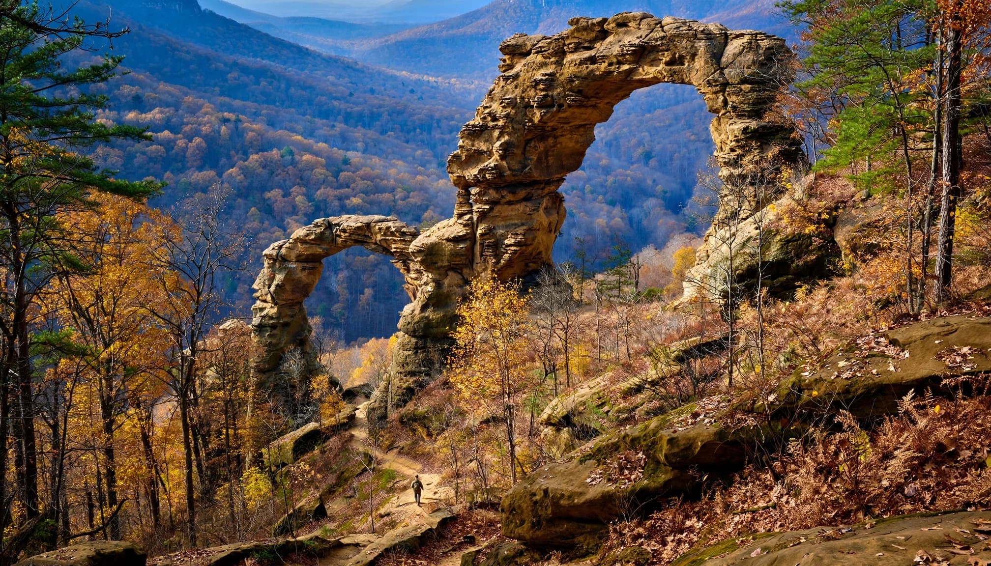
The National Park Service lists Twin Arches Trail at 1.4 miles round trip, rated moderate. You’ll encounter steep wooden stairs and cliff edges, so don’t mistake the distance for an effortless stroll.
The scale is impressive. North Arch has 51 feet of clearance, a 93-foot span and a deck 62 feet high. South Arch is larger, with 70 feet of clearance, a 135-foot span and a 103-foot-high deck.
If your goal is seeing the arches, the short trail is enough. Give yourself time underneath them rather than rushing straight back.
Choose the Loop for a Longer Forest Day
NPS lists Twin Arches Loop Trail at 4.6 miles, also moderate. This longer option descends into the forest toward Charit Creek Lodge, with roughly 400 feet of descent below the arches.
Having said that, you’ll have to regain that elevation. I recommend the loop when everyone wants several hours of walking, rather than adding it because the short trail sounds too easy.
The trailhead is on the park’s western side, reached using gravel Divide Road. Allow extra driving time and keep the return climb in mind.
Yahoo Falls and Slave Falls for Waterfall Days
Yahoo Falls Is the Beginner-Friendly Pick
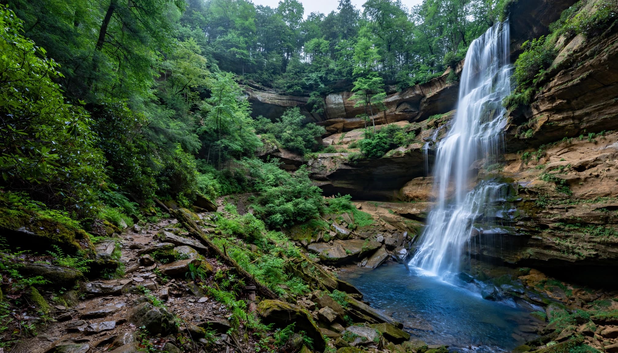
The falls, at 113 feet, are described as Kentucky’s tallest. The approximately 1.2-mile walk is easy overall, although stairs and damp footing deserve attention.
This is my recommendation when you want a satisfying short outing without committing most of the day. Expect a wooded setting and a sandstone shelter beneath the cliff, rather than constant open views.
A 0.8-mile spur reaches Yahoo Arch. Treat that as additional walking, separate from the falls route, and leave time to retrace the spur.
Waterfall flow varies with rainfall. Wetter periods improve the show, but slick rock can make an otherwise manageable trail less forgiving.
Slave Falls Adds a Smaller Arch Nearby
From Sawmill Trailhead, Slave Falls is about 2.6 miles round trip as an out-and-back. The waterfall drops approximately 60 feet, making this another rewarding choice for a shorter hiking day.
Needle Arch is about 0.25 mile farther along the Slave-Falls-Charit-Creek connector. Remember that continuing to the arch also adds the return distance.
I’d choose this pairing when you want both the falls and an arch without taking on Honey Creek’s scrambling. Stay on the established route around rock shelters, and avoid climbing wet stone for a better photo.
Blue Heron and Honey Creek for Gorge Scenery
Blue Heron Combines River Views and Mining History
The NPS Kentucky trail guide lists Blue Heron Loop as a 6.5-mile moderate hike. Start at the Blue Heron Mining Community and hike clockwise.
You’ll get the Cracks in the Rocks passage, gorge scenery and steep stairs. This is a stronger choice than the short arch walks when you want a substantial day on the trail.
Blue Heron was a company town operated by the Stearns Coal and Lumber Company, also called Mine 18. Leave time to explore the historic community rather than treating it only as a parking area.
The stairs are the main trade-off. If knees or sustained climbs are a concern, choose a shorter outing.
Honey Creek Deserves Its Strenuous Rating
Honey Creek Loop is roughly 5.5 miles, with rock scrambling, stream crossings, narrow passages and confusing junctions. NPS recommends at least five hours, even for experienced hikers.
Backyard Knoxville recommends hiking counterclockwise and allowing about an hour per mile. That’s a useful planning pace here.
Honey Creek can take most of a day despite its modest mileage. Scrambling, creek crossings and route-finding slow progress considerably.
Don’t attempt it when water levels are up or when the route is icy. Heavy rain and freezing conditions are reasons to choose another trail.
Ask park rangers about creek conditions before committing. For a beginner’s first Big South Fork trip, I’d put Honey Creek behind Twin Arches and Blue Heron.
Parking, Navigation and What to Carry
Match Your Parking Area to Your Main Hike
Use Twin Arches Trailhead for the arches, Sawmill Trailhead for Slave Falls, Yahoo Falls parking for the short walk to the falls, and the mining community for Blue Heron Loop.
Honey Creek has its own southern trailhead, roughly an hour’s drive from Bandy Creek Visitor Center. It doesn’t make a convenient last-minute addition to an already full day.
For a quick gorge view, East Rim Overlook involves roughly a 0.1-mile walk. Its access is off the Leatherwood Road/Highway 297 corridor, making it a useful short stop when traveling from park headquarters.
Download the official park trail maps for the hiking trails before driving out. Cell service is unreliable across much of the park; Bandy Creek Visitor Center has WiFi.
Pack for Slippery Rock and Slow Miles
Bring water, food, rain protection, a headlamp and basic first-aid supplies. Carry a paper map as a backup to your downloaded route.
Footwear needs dependable grip on wet sandstone, roots and wooden steps. My guide to hiking boots for rocky trails compares options, but comfortable, grippy footwear matters more than buying the heaviest boot.
Bears can appear close to trailheads. One visitor reported a sighting less than two minutes from Twin Arches parking, so keep food secured and give wildlife plenty of space.
Camping and Planning a Longer Stay
Pick a Base Near Your Priority Trails
Bandy Creek Campground has 181 sites and makes sense for a Tennessee-side visit. The 45-site Blue Heron Campground is the smaller Kentucky-side option.
Alum Ford has six primitive, first-come sites at $15 per night. Choose it when you prefer a simpler campground and don’t need the developed facilities of the larger options.
For two days, I’d spend one around Twin Arches and another on the Kentucky side around the falls route or Blue Heron. That gives you variety without forcing several long hikes together.
With extra days, look into hikes such as Grand Gap Loop, Devils Jump, or Angel Falls. Pickett State Park is a separate visit, and mountain biking or kayaking can add another activity.
If you want another Kentucky trip built around sandstone arches and short gorge trails, my Red River Gorge hiking guide covers the easy routes I’d pick first.
Understand the Overnight Rules
Backcountry camping requires a backcountry permit. The NPS backcountry camping rules set fees at $5 for 1 to 6 people, $10 for 7 to 12, $15 for 13 to 18, and $20 for 19 to 24.
Keep campsites at least 100 feet from trails, roads, parking areas, arches, rock shelters, historic cabins and gravesites. Additional visibility restrictions apply near roads and parking.
For a non-hiking break, the Big South Fork Scenic Railway offers an approximately three-hour excursion. Allow about 30 minutes each way to Barthell and a two-hour layover. Give it its own block of time.
Frequently Asked Questions
Are Dogs Allowed on Big South Fork Trails?
Dogs are permitted on most trails, with a leash no longer than 6 feet (1.8 meters). Bring their water and pack out waste. Steep stairs and scrambling can make Twin Arches and Honey Creek awkward choices for some dogs.
Which Hikes Are Best With Children?
The 1.2-mile falls walk is the strongest waterfall starter, while East Rim Overlook offers a much shorter scenic stop. Twin Arches works for children comfortable with steep stairs, as long as adults supervise closely near cliff edges.
Can I Combine Twin Arches and Slave Falls?
Yes, but beginners should treat them as separate trailhead hikes rather than assume there’s a short, easy connection. Choose the 1.4-mile Twin Arches outing if you want enough energy for Slave Falls afterward.
What’s a Sensible First Backpacking Plan?
Keep daily mileage modest, use the mapped trail network and select legal campsites away from protected features. I’d build an overnight around a manageable route near Bandy Creek or Charit Creek, rather than make Honey Creek your introduction to carrying a loaded pack.
Build Your Trip Around One Main Hike
Twin Arches is the clearest first choice for natural arches, while Blue Heron gives you a fuller gorge day. Add Yahoo Falls or Slave Falls when you want water and a shorter outing.
The best plan leaves room for slower footing and scenic stops. Choose one main hike, keep a manageable backup, and let the terrain set your pace.