Linville Gorge backpacking is best suited to experienced hikers, but a shorter overnight with an experienced partner can be a manageable introduction. I’d choose a conservative out-and-back before attempting a full loop, especially with storm closures still affecting major connections.
The views are breathtaking, but mileage alone doesn’t describe the difficulty. Steep climbs, rough footing, scarce ridgeline water, and unreliable cell service all affect your plans.
Start with access and permits, then build your route around water and realistic camping options.
Key Takeaways
- Free overnight permits are required on weekends and federal holidays from May 1 through October 31.
- Current reservations use advance and Wednesday releases, rather than the older phone-and-Friday walk-in system.
- Storm closures interrupt full-gorge loops, and the river bridge remains washed out.
- Carry offline navigation, a paper map, treated drinking water, and secure food storage.
Start With Terrain and Current Access
Expect slow, demanding miles
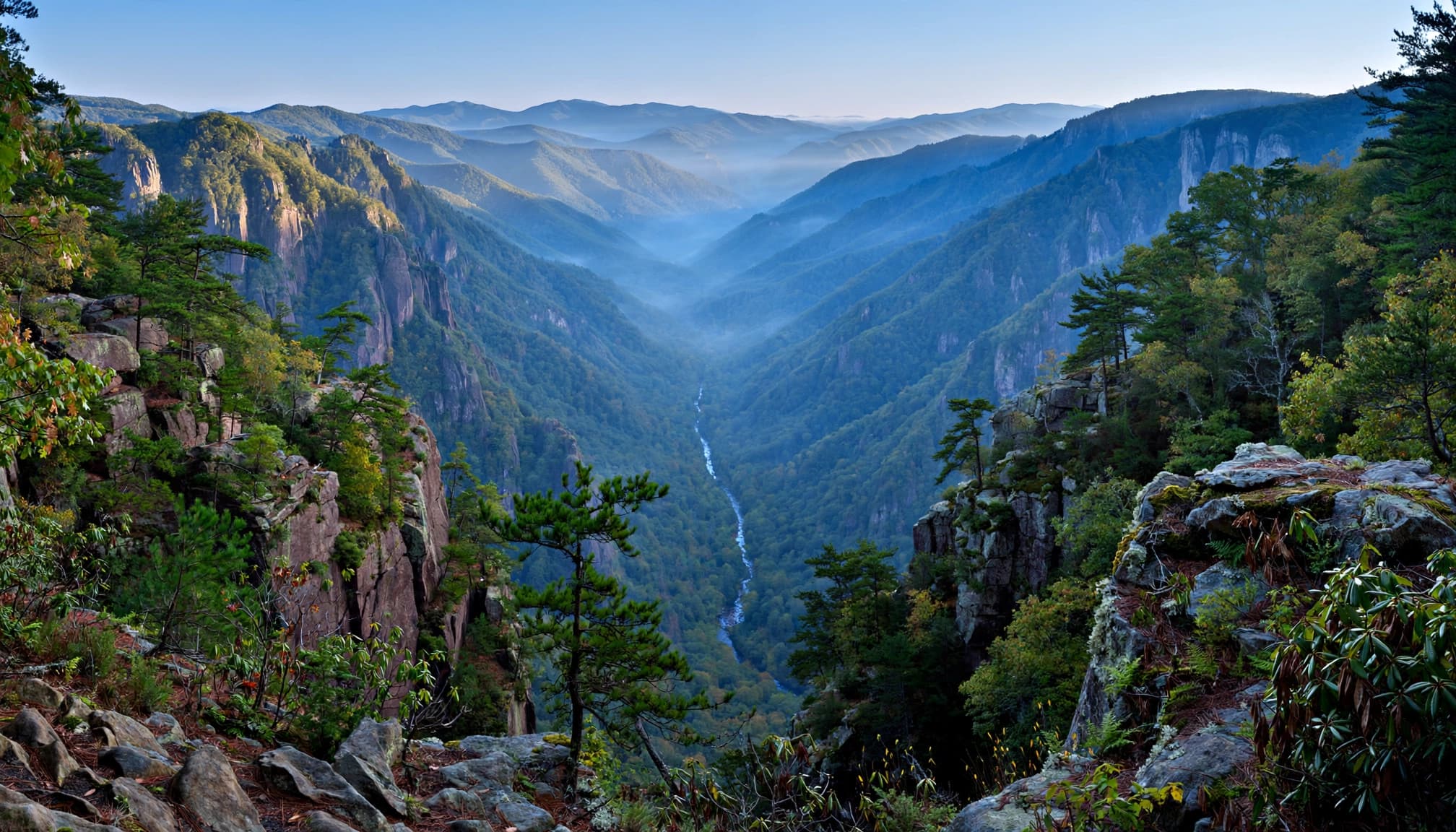
The approximately 11,786-acre wilderness lies within Pisgah National Forest and is known as North Carolina’s “Grand Canyon of the East.” The Linville River drops about 2,000 feet during its roughly 13-mile passage through the gorge.
That’s impressive scenery, but it also means strenuous climbs between the river and rim. Trails are rocky, steep, and often poorly marked. Some connections are unmaintained.
For beginners, I’d keep the first trip short enough to retrace comfortably. If you want an easier introduction, my North Carolina waterfall hikes include beginner-friendly Linville Falls overlooks.
October 2026 closures affect route choices
The Forest Service’s wilderness information lists Table Rock Picnic Area, Greentown Shortcut Trail, and portions of the Linville Gorge Trail as closed following storm damage.
Closed river-trail sections include Daffodil Flats to Pinch-In, Spence Ridge to Conley Cove, and Cabin to Bynum Bluff. Marked restrictions also affect Shortoff North cliff-rim areas and campsites.
The wilderness remains open, but routes that cross closed sections aren’t usable itineraries.
Linville Gorge Backpacking Permits and Limits
Reserve through the current system
Overnight wilderness permits are free and required on weekends and federal holidays between May 1 and October 31. Day hiking doesn’t require this overnight permit.
Use the overnight permit reservation page. The nightly quota is 50 people, with two releases:
| Release | Availability | When it opens |
|---|---|---|
| Advance | 35 people per night | First day of the preceding month |
| Short-notice | 15 people per night | Wednesday at 10 a.m. Eastern for the coming weekend |
For an October trip, advance availability opens September 1. These are spaces for people, not 50 separate group permits.
Older instructions describe advance phone reservations and 15 Friday walk-in permits released at 10 a.m. Those aren’t the current published process. The Linville Gorge Information Cabin is also listed as closed.
Keep the trip within wilderness limits
Each visitor or group may receive one weekend reservation per month. Maximum group size is 10 people, and stays are limited to three consecutive days and two nights.
The stay limit still applies when seasonal overnight authorization isn’t required. Nonholiday weekday camping and trips between November 1 and April 30 generally don’t require the overnight permit.
Having said that, November brings shorter days and colder nights. An easier permit calendar doesn’t make the hiking easier.
Compare the Main Backpacking Routes
These distances describe different outings, not interchangeable versions of one loop. Full circuits depend on connections currently affected by closures.
| Route or itinerary | Approximate distance | Main consideration |
|---|---|---|
| Shortoff ridgeline outing | 8 miles | Stronger first-trip option; limited water |
| river-bridge approach | 1.75 miles each way | Bridge washed out |
| Devil’s Hole | 1.5 miles each way | Steep descent and scrambling |
| Conley Cove | 1.4 miles each way | Demanding return climb |
| Classic full-gorge loop | 32 to 33.5 miles | Experienced backpackers; interrupted connections |
| Shortened three-day itinerary | About 20 miles | Route-specific, not the classic loop |
| Extended counterclockwise circuit | About 40 miles | Extra connections and mileage |
I’d choose a Shortoff Mountain out-and-back, outside closed areas, rather than a full circuit for a first visit.
A point-to-point itinerary needs reliable transport or a shuttle. A conservative out-and-back avoids depending on closed connections.
East rim: Shortoff, Spence Ridge, and Table Rock
Shortoff follows part of the Mountains to Sea Trail and is among the clearest-marked options for newcomers.
This route offers comparatively easier access to the gorge floor. Its former river bridge is washed out, so continuing across requires a wet crossing.
Devil’s Hole drops approximately 1,160 feet, with stream rock-hopping and a short hands-required cliff scramble before connecting with the Linville Gorge Trail.
The Chimneys offer technical rock climbing, but their climbing approaches aren’t an established trail connection.
Table Rock’s summit reaches 3,680 feet, accessed by a short, steep summit trail. Little Table Rock descends roughly 1,000 feet toward that same river approach. The picnic-area closure affects this approach.
West rim: Conley Cove
Conley Cove is one of the more manageable west-rim descents, but the climb back remains strenuous.
It reaches the river corridor. Closed connections prevent assuming you can continue along the gorge floor to another exit.
Choose Campsites Before You Need Them
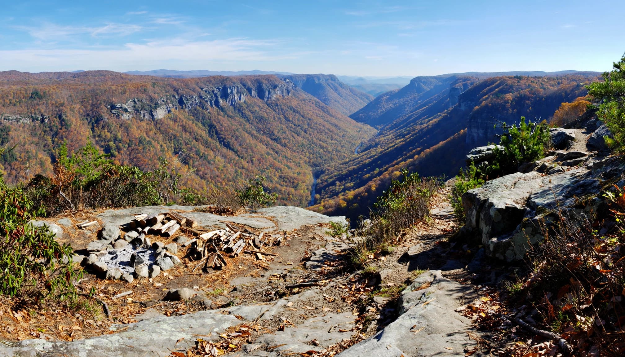
Your permit doesn’t reserve a tent pad. Plan a primary camping area and a backup, both outside closures.
Big Flat Rock Overlook is a well-known Shortoff camping area. Keep in mind, though, a scenic reputation doesn’t establish availability or override restrictions.
Choose an existing, durable site with shelter from wind. Stay away from cliff edges, drainage channels, dead overhead branches, and low riverbanks.
Camping is prohibited within 200 feet of designated trailhead parking areas, including the river-bridge access, Conley Cove, Pinch-In, Hawksbill, and several western access points.
Free parking is available at Wolf Pit Trailhead, the southern Shortoff starting point. East-rim access information identifies Gingercake Road, FR 210, and Table Rock Picnic Access as major approaches. Table Rock’s current closure means it isn’t an available starting point.
Arrive with enough daylight to find camp without settling for unsafe ground.
Plan Water and River Crossings Separately
Treat natural water, but understand the limits
There’s no treated or potable water inside the gorge. Treat every natural source before drinking, and carry a backup treatment method.
Water is scarce along the eastern rim. A spring marked on a map may be dry, so don’t plan a dry camp around one uncertain source.
The Linville River may carry agricultural runoff. A standard water filter may remove common pathogens, but it won’t reliably remove dissolved chemicals. Choose suitable upstream tributary sources where available, and don’t assume clear water is safe.
Carry enough for the dry stretch, dinner, breakfast, and your next reliable refill.
Don’t make a ford mandatory
The Spence Ridge bridge was the gorge’s river bridge; it remains washed out. Older descriptions that promise a bridge crossing are outdated.
A photograph of a shin-deep ford tells you nothing about today’s current. Rain upstream can change river conditions quickly.
A campsite on the opposite bank turns a river crossing into a commitment. Keep your overnight plan on one side whenever possible.
If the river is high, fast, or rising, turn back. Avoid river-dependent itineraries during heavy-rain periods, including routes that stay close to flood-prone banks.
Set Up Navigation and Pack for Delays
Make your map work without service
Cell service is sparse to nonexistent. Bring a physical topographic map and compass, and know how to use them.
The free Avenza app supports offline GPS positioning, although individual maps may cost extra. Download a georeferenced Avenza map at home, open it in airplane mode, and confirm your position displays.
Mark your trailhead, campsite options, water sources, closure boundaries, and turnaround points. Water symbols identify possible sources, not guaranteed flow.
Many dotted-line routes on local maps are unofficial social trails rather than Forest Service trails. Read the legend. These paths can be overgrown and much rougher than established routes.
If a junction doesn’t match your map, stop and locate your last known position.
Pack food storage, weather protection, and backup power
There’s no food resupply inside the gorge. Bring every meal and enough extra food for an unexpected delay.
Black bears, raccoons, and mice all seek easy meals. Use a bear canister, an appropriately secured Ursack, or a correctly hung bear bag where conditions allow. Store food, trash, and scented toiletries together, away from your sleeping area.
I’d favor a canister if you’re inexperienced with hanging food.
Pack rain gear, insulation, a headlamp, first aid, dry sleep clothing, and spare phone power. A satellite messenger adds a useful safety margin. During hunting season, wear blaze orange.
Build a Conservative First Overnight
For a first Linville Gorge backpacking trip, I’d use this sequence:
- Choose dates and secure the permit. Keep the group small and the itinerary within two nights.
- Start at Wolf Pit with full water containers. Follow the established Shortoff route, with a turnaround before any marked closure.
- Camp at a legal existing site and retrace your approach. Keep river crossings and uncertain connecting trails out of the plan.
The approximately 8-mile ridgeline outing is a reference, not a mileage requirement. Shorten it to suit your group’s fitness and water capacity.
Choose spring or fall for more comfortable hiking, but expect cold nights and wet rock. Start early in summer and leave exposed ridges before thunderstorms develop.
Leave your route, vehicle details, return time, and overdue-response plan with someone at home.
Frequently Asked Questions
Is Linville Gorge free?
Wilderness access and overnight permits are free. Overnight authorization is still required on covered weekends and federal holidays during the May-through-October season.
Is Linville Gorge suitable for beginner backpackers?
A short, carefully planned trip with an experienced partner can work. I wouldn’t recommend a full-gorge loop as someone’s first backpacking trip.
Can you backpack beside the river when water is high?
Avoid that plan. High water threatens crossings and low campsites, while storm damage already interrupts several river-trail connections.
What are the “big three” trails?
There’s no official Linville Gorge grouping with that name. Choose named trails and mapped connections rather than relying on an informal label.
Keep Your First Gorge Trip Simple
The strongest first itinerary gives you room to turn around. A short route, legal campsite, dependable water plan, and familiar return trail matter more than completing a famous loop.
Save the longer circuit for a trip when its connections are open and your group has the experience to handle them. You’ll have more time to enjoy the gorge without racing daylight.