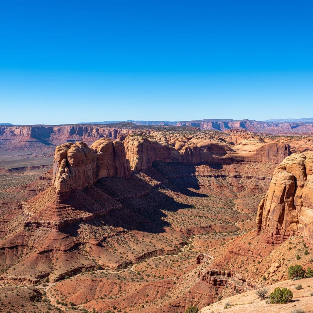
Capitol Reef gets less attention than the other Utah Mighty 5 parks, and that’s part of its appeal. The park is long and narrow, built around the Waterpocket Fold (a 100-mile geologic warp in the Earth’s crust), and most of the famous sights are concentrated in a tight corridor along Highway 24 and the Scenic Drive. A first visit is much simpler than the map looks at first.
This guide covers what to mark on your map first, which trails are worth picking for a one-day visit, and which areas to save for a return trip with a more capable vehicle.
Before you go
- Park entrance: free. There’s no fee to drive Highway 24 through the park or to visit Fruita and the visitor center
- Scenic Drive fee: $20 per vehicle for 7 days (the only fee inside the park)
- Visitor Center: on Highway 24 in Fruita, near the orchards
- Best season: spring (April-May) and fall (September-October). Summer is hot but doable; winter brings snow at higher elevations
- Cell service: limited; near-zero in canyons and backcountry. Download maps before you arrive
- Nearest base town: Torrey, Utah, about 11 miles west of the visitor center on Highway 24
The park’s shape: the Waterpocket Fold
Capitol Reef is built around the Waterpocket Fold, a long, narrow ridge of folded sandstone and other layers. The main visitor corridor runs east-west along Highway 24, which follows the Fremont River through a gap in the Fold. The Scenic Drive runs south from the visitor center along the western edge of the Fold.
The rest of the park, the Cathedral District to the north and the Waterpocket District to the south, requires high-clearance vehicles and a real time commitment. The standard first visit stays in the Fruita corridor.
What to mark on the map first
| Stop | What it is | Distance / effort |
|---|---|---|
| Visitor Center | Orientation, current conditions, paper map, restrooms | Drive-up |
| Fruita Historic District | Pioneer orchards (~1,900 trees), Gifford Homestead, Fruita Campground | Drive-up + short walks |
| Petroglyph Panel | Boardwalk to Fremont Culture rock art on Highway 24 | Drive-up boardwalk |
| Scenic Drive | 7.9-mile paved one-way drive through the western Fold | ~1.5 to 2 hours with stops |
| Hickman Bridge | 1.8 mi RT, ~400 ft gain, moderate; 133-ft natural bridge | 1.5 to 2 hours |
| Capitol Gorge | 2 mi RT, mostly flat; historic inscriptions and natural water “tanks” | 1 to 1.5 hours |
| Grand Wash | 4.4 mi RT through a wide canyon, easy | 2 to 3 hours |
| Cassidy Arch | 3.4 mi RT, ~670 ft gain, strenuous; ends at an arch you can stand on top of | 2 to 3 hours |
| Chimney Rock | 3.6 mi loop, ~600 ft gain; panoramic ridge views | 2 to 3 hours |
Most first-timers don’t need more than this. Pick the visitor center + Fruita + Scenic Drive + one trail, and you’ve covered the park’s famous corridor.
A simple first-day route
- Stop at the visitor center for current trail conditions and to pay the Scenic Drive fee
- Walk the orchard paths in Fruita; the Gifford Homestead sells homemade pies (cash or card) when in season
- Drive the Scenic Drive, stopping at pullouts along the way
- Pick one trail: Hickman Bridge for the classic arch hike, Capitol Gorge for an easy canyon walk, or Cassidy Arch if you want a tougher day
- Cap the day with the Petroglyph Panel on Highway 24 and sunset light on the Fold
That’s a full day without rushing. Skip the trail you’re least excited about if you’re tight on time or arrived in the heat.
Cathedral Valley and the Waterpocket District
The Cathedral Valley Loop is a 57.6-mile dirt road loop through monolithic sandstone formations in the park’s remote north section. NPS recommends high clearance (4WD is helpful but not always required if conditions are dry), and the loop takes 6 to 8 hours of slow driving. It crosses the Fremont River at a ford, which can be impassable when water is high.
The Burr Trail and Notom-Bullfrog Road run along the eastern side of the Waterpocket Fold to the south, with the famous Burr Trail switchbacks as the highlight. Both are dirt roads with sections that require high clearance.
None of these are first-trip routes. Save them for a return visit with the right vehicle.
Mistakes first-time visitors make
The first is underestimating heat and sun exposure. Most of the trails have minimal shade. Carry more water than you think you need (NPS recommends a gallon per person per day in summer), wear sun protection, and start hikes early.
The second is ignoring flash flood risk in slot canyons and washes. Even small rainstorms upstream can send a wall of water through a canyon hours later. The NPS lists Sulphur Creek, Grand Wash, and Capitol Gorge among the flash-flood-prone routes. Check the weather forecast for the entire upstream watershed before entering any canyon or wash, and don’t go in if storms are forecast.
The third is relying on cell service. Coverage is unreliable inside the park. Download offline maps, carry a paper map, and let someone know your plan if you’re heading into a longer trail or backcountry route.
If you’re building a bigger Utah trip
Capitol Reef pairs naturally with Bryce Canyon (about 2 hours south on Highway 12), Escalante and the Grand Staircase area (along the same highway), and Goblin Valley State Park (north). For a broader Utah list, see the best hikes in Utah roundup.
Frequently asked questions
Does Capitol Reef have an entrance fee?
Entering the park is free. You can drive Highway 24 through the park, visit the Fruita historic district, the visitor center, and Highway 24 viewpoints without paying. The Scenic Drive (the 7.9-mile paved road south from the visitor center) has a $20 per-vehicle fee for 7 days. America the Beautiful annual passes cover the Scenic Drive fee.
How long should I plan for the Scenic Drive?
Plan 1.5 to 2 hours including stops. The road is 7.9 miles one way, paved, and easy for any passenger vehicle. The Capitol Gorge spur at the end adds a short additional gravel section.
What should first-time visitors prioritize?
The visitor center, Fruita Historic District, the Petroglyph Panel on Highway 24, the Scenic Drive, and one trail (Hickman Bridge is the safest pick for most first-timers). If you have a second day, add Cassidy Arch or Chimney Rock.
Do I need a 4WD vehicle?
Not for the standard first visit. Highway 24, the Scenic Drive, and the trailhead access roads are all paved or maintained gravel suitable for any passenger car. Cathedral Valley, the Burr Trail, and Notom-Bullfrog Road require high clearance and benefit from 4WD.
Can I pick fruit in the Fruita orchards?
Yes, during the harvest season (typically June through October, depending on the fruit). Sampling fruit inside the orchard is free; fruit you take out is sold by weight at self-service stations. The NPS posts which orchards are open to picking and which fruits are in season.
What’s the flash flood risk?
Real and serious. Slot canyons, washes, and gorges (Sulphur Creek, Grand Wash, Capitol Gorge, and others) can flood violently when storms hit upstream watersheds, even if it’s sunny over your head. Check the full weather forecast before entering any canyon, and don’t go in if rain is in the forecast anywhere in the broader region.