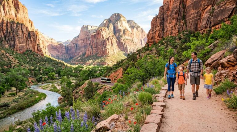
Great Smoky Mountains is the most-visited national park in the country (12 to 13 million people a year) and one of the most map-dependent. The park has no entrance fee but does require a Parking Tag for any stop over 15 minutes. Roads cross between Tennessee and North Carolina, areas don’t all open at the same time of year, and the famous Clingmans Dome was officially renamed Kuwohi in 2024. First-time visitors who don’t sort the basics in advance lose a lot of time.
This guide explains the park’s main zones, which entrances make sense from where, and the 2026 parking-tag and vehicle-free-day rules that aren’t obvious until you arrive.
Before you go
- Entrance fee: free. Great Smoky has no entrance fee
- Parking Tag (Park IT!) is required for any vehicle stopped longer than 15 minutes: $5/day, $15/week, $40/year. License-plate tied, must be physically displayed (no digital). Buy at recreation.gov/activitypass/AP2510 or in person at visitor centers
- America the Beautiful and other federal passes do NOT cover the parking tag
- Tag not required on NPS Fee-Free Days (Feb 16, May 25, June 14, July 3-5, Aug 25, Sep 17, Oct 27, Nov 11 in 2026)
- Park hours: open year-round, 24/7; visitor centers closed on Christmas Day
- Main gateways: Gatlinburg (TN, NW), Cherokee (NC, S), Townsend (TN, W), Bryson City (NC, S)
- Newfound Gap Road (US-441) is the only road that crosses the park between TN and NC, 33 miles
- Cell service is limited park-wide; download maps and audio guides before you enter
2026 closures and schedule changes
- Cades Cove Vehicle-Free Days: Wednesdays from May 1 through September 25, 2026. The loop is open to walkers and cyclists only on those days; cars cannot enter
- Roaring Fork Motor Nature Trail: closed through at least May 28, 2026; verify current status
- Laurel Falls Trail: closed for rehabilitation work (multi-year project); check NPS conditions
- Big Creek area: partial damage from Hurricane Helene; the first ~2 miles to Mouse Creek Falls are reportedly accessible; verify before driving in
- Name change: Clingmans Dome was renamed Kuwohi (the original Cherokee name) in September 2024. NPS signage, maps, and visitor center now use Kuwohi
The park’s main zones
| Zone | What it offers | Best for |
|---|---|---|
| Sugarlands / Newfound Gap (TN central) | Sugarlands Visitor Center, easy waterfall trails, Mount LeConte trailheads, the road over to NC | First-time visitors entering from Gatlinburg |
| Cades Cove (TN west) | 11-mile one-way loop, historic cabins and churches, wildlife (bears, deer) | Wildlife watching, photography, slow scenic drives |
| Oconaluftee / Cataloochee (NC south) | Mountain Farm Museum, elk herd in Cataloochee, quieter trails | Elk viewing, NC side base, quieter pace |
| Kuwohi area (TN/NC border) | Highest point in the park at 6,643 ft, observation tower, AT crossing | Big views, sunset, longer hikes |
| Deep Creek (NC south) | Cascading waterfalls, tubing | Family-friendly water day |
Which entrance makes sense
- Gatlinburg (TN, northwest) — closest to Sugarlands Visitor Center and Newfound Gap Road. Most-used entrance, most lodging
- Townsend (TN, west) — closest to Cades Cove; quieter base than Gatlinburg
- Cherokee (NC, south) — closest to Oconaluftee Visitor Center and the Mountain Farm Museum; also the easternmost entry on the Blue Ridge Parkway
- Bryson City (NC, south) — closest to Deep Creek; smaller, quieter
Trails worth marking on the map
- Kuwohi (Clingmans Dome) Observation Tower — 1 mi RT paved, steep; the highest point in the park
- Alum Cave Trail — 4.6 mi RT to Alum Cave Bluffs; 11 mi RT continuing to Mt LeConte summit (one of three routes up LeConte)
- Chimney Tops — 4 mi RT; the iconic spires, with the final 0.25 mi to the actual chimneys closed since the 2016 wildfires
- Charlies Bunion — 8 mi RT from Newfound Gap on the AT; classic ridge view
- Abrams Falls — 5 mi RT from Cades Cove Loop; popular waterfall hike
- Andrews Bald — 3.5 mi RT from Kuwohi parking; grassy meadow ridge with panoramic views
- Cucumber Gap or Little River Trail — Elkmont area; quieter creek-side options
Where to base yourself
- Gatlinburg, TN — most lodging, restaurants, and access to Newfound Gap Road. Loud, crowded, with strong commercial character
- Townsend, TN — quieter, “the peaceful side of the Smokies”; closer to Cades Cove
- Pigeon Forge, TN — between Knoxville and Gatlinburg; Dollywood territory
- Cherokee, NC — for the NC side; close to Oconaluftee and Mountain Farm Museum
- Bryson City, NC — smaller NC base; close to Deep Creek
A one-day plan
For a first one-day visit from the Gatlinburg side:
- Buy a Parking Tag online before you arrive (or at Sugarlands when you get there)
- Sugarlands Visitor Center for current trail conditions and the park film
- Drive Newfound Gap Road south to Newfound Gap (the TN/NC line and AT crossing)
- Continue 7 miles up Clingmans Dome Road to the Kuwohi parking lot; walk the paved trail to the observation tower
- Return north on Newfound Gap Road; hike Alum Cave Bluffs (4.6 mi RT)
- Optional add: drive Roaring Fork Motor Nature Trail (when open) for waterfall stops
For a two-day plan, see the Great Smoky Mountains weekend itinerary. For waterfall-focused picks, the easy waterfall hikes guide covers shorter trails.
Pairing the Smokies with nearby parks
- Shenandoah National Park — about 6 hours north along Skyline Drive and the Blue Ridge Parkway
- New River Gorge National Park — about 5 hours north in West Virginia, the newest US national park
- Congaree National Park — about 4 hours southeast in South Carolina
Frequently asked questions
Do I need a parking tag at Great Smoky Mountains in 2026?
Yes, for any vehicle stopped longer than 15 minutes. Tags are $5 per day, $15 per week, or $40 per year, all tied to your license plate. Buy them online at recreation.gov before you arrive, or in person at Sugarlands, Cades Cove, Oconaluftee, or Kuwohi visitor centers. Federal interagency passes (including America the Beautiful) do NOT cover the parking tag.
Wait, isn’t this Clingmans Dome?
It was. In September 2024, the National Park Service officially renamed Clingmans Dome to Kuwohi, restoring the original Cherokee name (Kuwohi means “mulberry place”). NPS signage, the visitor center, and park maps now use Kuwohi. Many third-party maps and guides still use the old name during the transition.
When is Cades Cove vehicle-free?
Every Wednesday from May 1 through September 25, 2026. On those days the 11-mile loop is open only to walkers, cyclists, and runners. Cars are blocked from the loop. Many visitors plan a Wednesday morning bike ride around the loop, which is one of the best ways to experience the cove without traffic.
What’s the best entrance for first-time visitors?
Gatlinburg via Sugarlands, for most first visits. It’s the busiest, but it gives the easiest access to Newfound Gap Road, the Kuwohi spur, Alum Cave Trail, and Chimney Tops. Use Townsend if you want a quieter base and Cades Cove is your priority; use Cherokee if you’re approaching from the south on the Blue Ridge Parkway.
How long should I plan?
One day for a sampler; two to three days to see Sugarlands plus Kuwohi plus Cades Cove plus Oconaluftee. The park is bigger than a single day’s coverage allows. Most first-timers come away wishing they’d planned an extra day.