Smith Rock looks like the kind of place you need to earn with a massive hike. You don’t. Smith Rock State Park hiking can be as simple as a peaceful river walk, or as hard as a steep climb with canyon views that feel way bigger than the mileage.
For a first visit, I recommend one classic route, one short add-on, and plenty of time to stare up at the cliffs. The park is compact, but the sun, steep terrain, and weekend crowds can turn a casual plan into a long day fast.
Key Takeaways
- The best all-around first hike is the Misery Ridge Loop, but it is steep and gains about 910 feet in 3.6 miles.
- River Trail is the lower-stress choice for canyon scenery, river views, and a close look at Monkey Face.
- Arrive early on weekends, especially from spring through fall. The main lot fills quickly.
- Bring more water than you think you’ll need. Smith Rock’s high-desert sun has a way of making short hikes feel longer.
- Dogs are allowed but must stay on a leash, and campers need to use the walk-in Bivouac campground.
- If you only have a few hours, don’t chase every trail. Pick one big view, then add an easy walk along the Crooked River.
Start With the Logistics Before You Hit the Trail
Smith Rock State Park sits near Terrebonne in Central Oregon, about 30 minutes from Redmond Oregon and roughly 45 minutes from Bend Oregon. It’s an easy day use destination, which is exactly why it gets busy.
Parking, hours, and the best arrival time
The park is open from dawn to dusk, defined by Oregon State Parks as 30 minutes before sunrise until 30 minutes after sunset. Plan to be at the parking lot by 8:00 a.m. on a weekend if possible. Early bird like me? You’ll get cooler temperatures, better light on the cliffs, and a far less stressful parking situation.
A day use parking pass is required. Fees and payment options can change, so check the current Oregon State Parks listing before your visit. You can buy a pass at the park or online on the day of your visit. The park lists accessible facilities near the main area, but its rocky, steep trails aren’t broadly accessible. Check the official Smith Rock State Park page for current fees, parking conditions, accessibility details, and alerts.
What to bring for a first hike
This isn’t a huge wilderness park, but treat it like a real hike. Much of the trail network is exposed, rocky, and dry.
Pack water, salty snacks, sunscreen, sunglasses, and a fully charged phone. Download the official trail map for offline use before leaving home. Trail runners or hiking shoes with decent grip are usually enough. Flat-soled casual sneakers are where people get into trouble, especially on dusty switchbacks and loose rock.
Smith Rock’s high desert sun is often harder than the mileage. Start early, take breaks before you’re overheated, and save your summit push for cooler hours.
Choosing the Best Smith Rock State Park Hiking Trail
The best trail depends on what you want from the day. Big views and a hard climb? Misery Ridge. A calmer introduction with consistent scenery? River Trail. More time and stronger legs? Build a longer loop around the upper trails.
River Trail and Canyon Trail for a gentler first outing
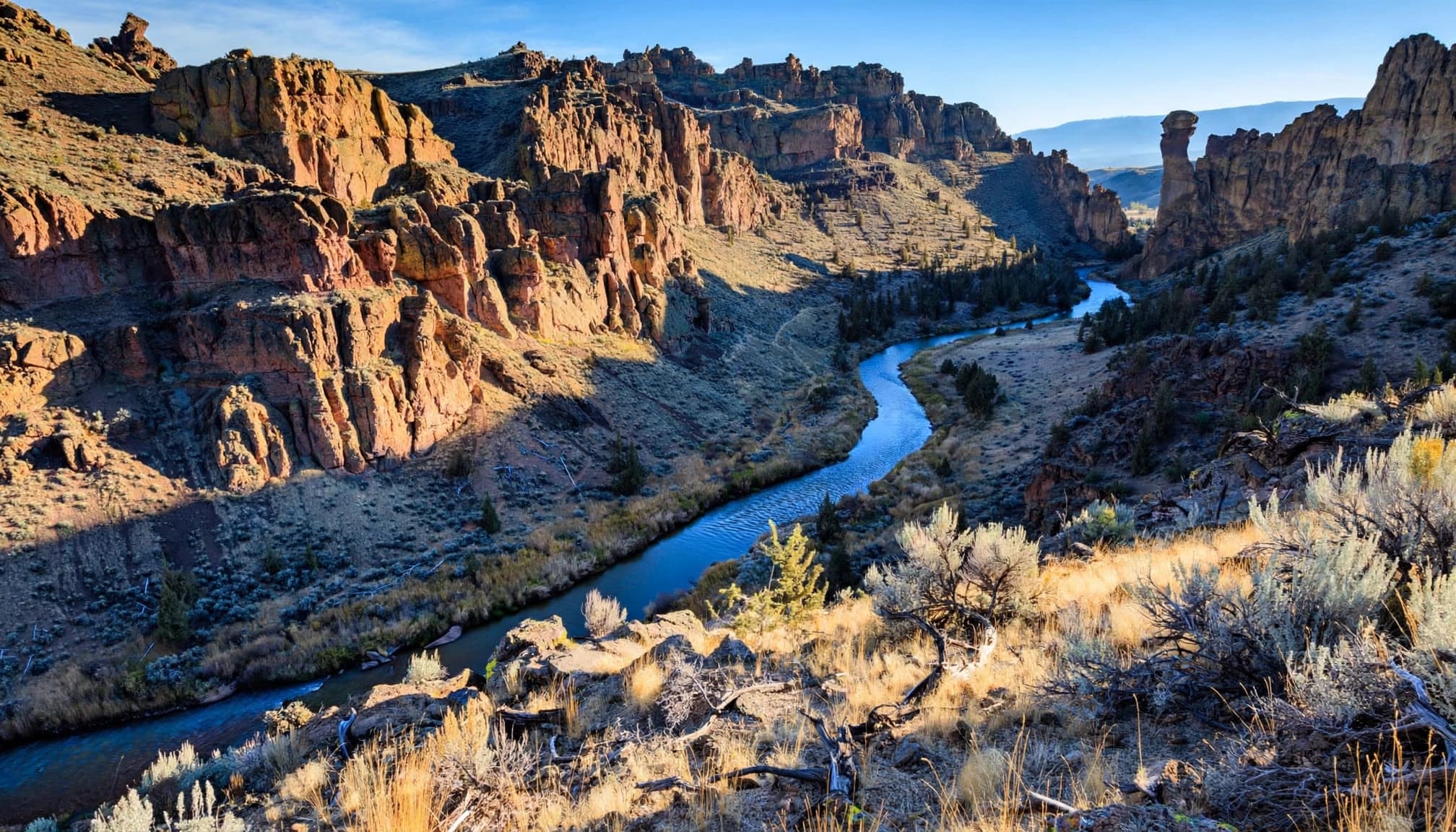
River Trail is my pick for beginners, mixed groups, or anyone who wants the best effort-to-reward ratio. The route follows the Crooked River beneath the climbing walls, with constant views of volcanic cliffs, juniper, and the famous Monkey Face formation.
A River Trail out and back to the viewpoint is about 4 miles round trip, with roughly 460 feet of elevation gain. It isn’t perfectly flat, but it feels far more forgiving than Misery Ridge. Expect packed dirt, rocky patches, occasional roots, and some short ups and downs.
Canyon Trail is another useful connector near the river. The Oregon State Parks trail map labels it at 1.6 miles. Pair it with River Trail when you want to stretch the day without committing to the steep ridge.
Misery Ridge delivers the classic Smith Rock view
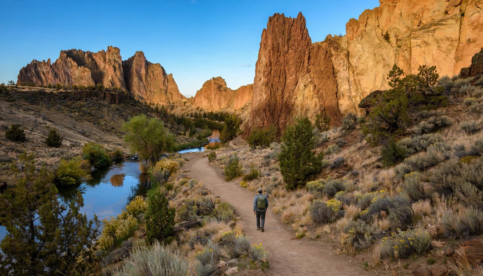
Misery Ridge is the hike people picture when they talk about Smith Rock State Park hiking. The Misery Ridge Loop is a strenuous hike and a classic loop trail, with expansive scenic views over the Crooked River, the Cascades, and the maze of rust-colored rock below.
The full Misery Ridge Loop is about 3.6 miles, with 910 feet of elevation gain. The distance is modest. The climb is not. You’ll gain most of that elevation quickly on exposed switchbacks, so don’t treat this as a casual stroll after brunch.
I recommend hiking uphill on Misery Ridge and returning via the River Trail. Get the steep work done early, then let the river section feel like a reward. Stop often near the viewpoint. You don’t need to race this one.
Longer routes for hikers with extra time
If Misery Ridge leaves you wanting more, look at the Summit Loop. Starting from the Welcome Center, this longer route is about 7.3 miles round trip and includes Summit Trail, Burma Road Trail, and Wolf Tree Trail.
The upper trail network also includes Mesa Verde Trail, which connects with nearby Summit and Homestead Trail sections. Burma Road helps link these higher routes. This is a better fit for hikers who have a full day, extra water, and some experience reading trail junctions.
The views are excellent, but the route has less of the instant drama found on Misery Ridge. Rim Rock Trail is the opposite experience. This roughly half-mile stroll offers a quick overlook and makes a nice warm-up or sunset add-on. Homestead Trail and Wolf Tree Trail can also help you create a quieter loop when the river corridor feels crowded.
Three First-Visit Itineraries That Actually Work
You don’t need to hike every named trail to feel like you saw Smith Rock properly. Pick a plan that matches your energy, then leave room for photos, snacks, and the inevitable stop to watch climbers on the walls.
The short scenic outing, about 1 to 2 hours
Start at the main parking area and take a portion of River Trail out and back along the Crooked River. Turn around whenever your group is ready, then add Rim Rock Trail before you leave.
This easy day use itinerary works well for families, new hikers, hot afternoons, or anyone passing through from Bend Oregon. Accessible facilities and some viewpoints are available near the main area, but River Trail has rocky, uneven surfaces and isn’t entirely accessible.
The classic half-day route, about 3 to 4 hours
Hike the moderate Misery Ridge Loop, climbing uphill first and descending along River Trail. Bring a lunch, take your time at the viewpoints, and stay after the hike for a relaxed walk near the river.
This is the sweet spot for most first-time visitors. It gives you Smith Rock’s postcard view, the park’s signature rock formation, and enough variety that the route never feels repetitive.
The full-day challenge, 5 or more hours
Start early and tackle the strenuous Summit Loop, or choose a longer route through Mesa Verde Trail, Canyon Trail, and River Trail. This is the plan for hikers who want more open high-desert terrain than a single ridge climb provides.
Bring extra water and expect more route-finding, exposure, and heat awareness. The longest day isn’t always the best day. If temperatures are rising or your group is slowing down, take the win and head back. Smith Rock is far more fun when you aren’t dragging through the final miles.
For more trail ideas around the state, these best Oregon hiking trails are a great next stop once you’ve had your fill of desert cliffs.
Heat, Wildlife, and Trail Etiquette
Smith Rock is beautiful because it’s exposed. That also means weather matters more than many first-time visitors expect.
Plan around the high-desert weather
Spring and fall are the easiest seasons for hiking comfort. Summer can be brutally hot by midday, even when mornings feel pleasant. Start early, wear a hat, and carry more water than you expect to need.
Before leaving, check Oregon State Parks alerts, fire restrictions, air quality, and any trail or park closures. Turn back or postpone your visit during dangerous heat, smoke, or an active closure. Winter hikes can be beautiful and much quieter, but icy trails, mud, and cold canyon winds are possible. Check the forecast and download the current trail map before you leave home. Cell service can be spotty in the canyon.
Give wildlife and other hikers room
The Crooked River corridor is a good place for wildlife viewing, including water birds, raptors, marmots, and other small animals around the rocks. Watch from a distance and don’t feed anything, no matter how friendly it looks.
Keep dogs leashed and pick up after them. Oregon State Parks also asks visitors to stay on marked trails because the high-desert environment is fragile. Shortcuts scar the hillside quickly, and loose soil doesn’t recover fast.
Camping and Seasonal Climbing Closures
A night at Smith Rock can be a great move if you want a dawn start. Just know that bivouac camping means walk-in tent sites, not drive-up campsites.
What to know about Bivouac camping
Smith Rock’s Bivouac area offers walk-in tent camping. Reservations aren’t accepted, so sites are first come, first served when available. RV camping, sleeping in vehicles, and open fires are not allowed.
Fees and seasonal operating dates can change, so check the park’s current visitor information before planning an overnight stay. Oregon State Parks lists current camping costs and availability there.
Bring a headlamp and warm layers for the walk from the parking area and your nighttime routine. Desert temperatures can drop sharply after sunset, even after a hot afternoon.
Raptor closures protect nesting areas
Smith Rock is a world-famous rock climbing destination, and some routes and climbing areas close seasonally to protect nesting golden eagles and falcons. Restrictions often run from around January 15 through August 1, though the exact areas and timing can change.
These are primarily climbing-area closures, not a reason to skip hiking. Trails may remain open, but visitors must follow posted signs and avoid restricted zones. Travel Oregon’s Smith Rock guidance is a helpful place to check for current closure context before a climbing-focused visit.
Smith Rock Hiking FAQs
Is Smith Rock good for beginner hikers?
Yes, if you choose the right trail. River Trail, Rim Rock Trail, and shorter routes near the Crooked River are approachable for beginners. Misery Ridge suits hikers comfortable with sustained uphill climbing and exposed sun.
How difficult is Misery Ridge Trail?
Misery Ridge is strenuous for its length. The 3.6-mile loop gains approximately 910 feet, much of it on a steep, exposed climb. Take it slow, bring plenty of water, and don’t be embarrassed by frequent breaks.
How long is the River Trail at Smith Rock?
River Trail distances vary depending on your turnaround point. A popular hike to Monkey Face is about 4 miles out and back, with approximately 460 feet of elevation gain. The terrain is mostly dirt and rock beside the river, with rolling sections rather than one major climb.
Are dogs allowed at Smith Rock State Park?
Dogs are allowed, but they must remain on a leash. Keep them close around climbers, wildlife, steep drop-offs, and narrow trail sections.
Can you camp overnight at Smith Rock?
Yes, tent camping is available in the walk-in Bivouac area. It isn’t an RV campground, vehicle sleeping isn’t allowed, and you can’t reserve a site ahead of time.
Make Your First Smith Rock Hike a Good One
Smith Rock rewards a simple plan. Hike Misery Ridge if you want the iconic view, choose River Trail if you want a lower-stress day, and start early before the heat and crowds take over.
The goal isn’t maximum mileage. It’s leaving with tired legs, a full water bottle, and the feeling that you experienced the park’s best hikes.