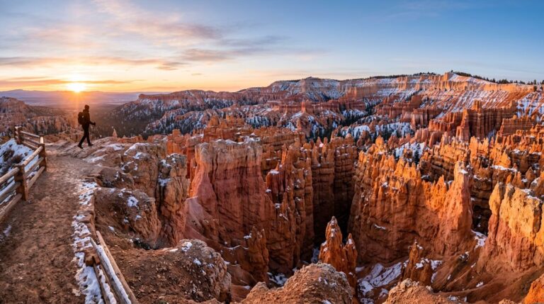
Sedona makes its case fast. A first-time visitor arrives at the red rocks expecting a single picture-postcard scene and discovers a whole hiking town with dozens of trails, a famous vortex map, and a parking system that’s stricter than most national parks. One well-paced day, with the right shuttle plan, can cover the highlights without burnout.
This itinerary is built around the practical realities of Sedona hiking: the Red Rock Pass requirement, the Sedona Shuttle’s Thursday-through-Sunday schedule, and the heat that builds fast on exposed red-rock trails by midday.
Before you go
- Red Rock Pass required at many Coconino National Forest Sedona Ranger District trailheads (Cathedral Rock, Soldier Pass, Devils Bridge area, others). $5/day, $15/week, $20/year. America the Beautiful annual pass works in place of the Red Rock Pass
- Sedona Shuttle is free and runs Thursday through Sunday on most weeks, with seven-day-a-week service during spring break (Feb 26 to Apr 26, 2026). Cathedral Rock and Soldier Pass trailheads are closed to private vehicles during shuttle operating hours; ride the shuttle to access them
- Drive times: Phoenix to Sedona ~2 hours; Flagstaff to Sedona ~45 minutes via Highway 89A; Grand Canyon South Rim to Sedona ~2.5 hours
- Best season: March-May and September-November. Summer is hot (above 90°F daily on exposed trails)
- Dark Sky community: Sedona is internationally recognized for dark-sky preservation, making it strong for stargazing
A one-day plan that works
| Time | Stop | Why it works |
|---|---|---|
| 6:30-8:30 am | Bell Rock Pathway loop (1 mi, easy) | Cool air, golden-hour light, easy parking |
| 8:30-9:30 am | Airport Mesa Loop (3.2 mi) | Vortex viewpoint, sweeping views of all the major formations |
| 9:30-10:30 am | Coffee or brunch in Uptown Sedona | Recover before the harder hike |
| 10:30 am – 1 pm | Cathedral Rock Trail (1.1 mi RT, 669 ft gain, strenuous) – via Sedona Shuttle | The signature scramble; classic red-rock summit view |
| 1-3 pm | Lunch in Tlaquepaque or Uptown | Air-conditioned recovery during the worst heat |
| 3-5 pm | Slide Rock State Park or Oak Creek Canyon drive | Cooler water and shaded canyon scenery |
| 5-7 pm | Sunset at Airport Mesa or Cathedral Rock viewpoint | The famous Sedona sunset light |

The morning: easy openers
Two short, easy options that work as morning warm-ups before the harder hikes:
- Bell Rock Pathway — about 1 mile of easy walking around the base of Bell Rock and Courthouse Butte. Optional summit scramble on Bell Rock itself (no marked route; not for first-timers). Trailhead off Highway 179 with its own parking; no Red Rock Pass required for the pathway
- Airport Mesa Loop — 3.2 mi loop around the mesa with two recognized vortex sites and the best 360-degree view in town. Parking limited; consider taking a Lyft
- Courthouse Butte Loop — 3.8 mi loop, ~300 ft gain, moderate. Less crowded than Bell Rock
Cathedral Rock: the signature hike
Cathedral Rock is the most-photographed formation in Sedona and the hike most first-timers come for. The trail is short but steep: 1.1 miles round-trip with 669 feet of elevation gain, and the final stretch is a hands-on-rock scramble through a sandstone gap to the saddle between the spires.
Parking is restricted. The Cathedral Rock Trailhead lot is closed to private vehicles during Sedona Shuttle operating hours. Take the free shuttle from the Park and Ride. The shuttle runs Thursday through Sunday on regular weeks, with seven-day spring break service in late winter to mid-spring.
Hike early to avoid heat and crowds. The summit area has limited footing and gets congested by 10am on weekends.
Other trails worth knowing
- Devils Bridge — Sedona’s largest natural arch. From the Mescal Trailhead, about 4 mi RT (easier; shuttle access). From the Dry Creek Road trailhead, about 5.8 mi RT. Standing on top of the arch is the iconic photo, but the rock is unfenced; don’t push to the edge
- Soldier Pass Trail — 4.5 mi RT past the Seven Sacred Pools and Soldier Pass Cave (a small alcove with a hand-and-foot scramble). Trailhead closed to private vehicles during shuttle hours; ride the shuttle
- Boynton Canyon — 6.4 mi RT, easy to moderate. A quieter, deeper canyon hike, with a vortex site at Subway Cave (a short side scramble)
- West Fork Trail in Oak Creek Canyon — 6.5 mi RT, easy, with multiple creek crossings. Cooler than the red-rock trails and shaded
Cooling off: Oak Creek and Slide Rock
Oak Creek Canyon runs north from Sedona along Highway 89A toward Flagstaff. The scenic drive is one of the best short canyon drives in Arizona. Two stops worth knowing:
- Slide Rock State Park — natural water slide carved into the creek bed; popular swimming spot in summer; $20-30 entry depending on season
- West Fork Trail — see above; one of the best moderate hikes in the area for hot afternoons
Similar Posts
Bryce Canyon National Park One-Day Hiking Plan With Sunrise Spots And Hoodoos
If you only have one day, Bryce Canyon hiking on Southern Utah’s Paunsaugunt Plateau is all about timing. I…
Capitol Reef Itinerary for One Day: Scenic Drives and Easy Hikes That Actually Fit
Only have one day in Capitol Reef? Good. Capitol Reef National Park, a hidden gem among Utah’s Mighty 5,…
Arches National Park Camping Near Moab: Where I’d Stay
Picking a campsite near Arches National Park in Moab, Utah is a lot like picking seats for a concert….
Olympic National Park Hiking Itinerary for 2 to 4 Days (Beginner-Friendly)
Olympic National Park on the Olympic Peninsula in the Pacific Northwest is the rare place where I can watch…
Sequoia National Park Easy Hikes for First Timers (Big Trees, Low Stress)
If it’s your first time in Sequoia, here’s the truth: you don’t need a big-mile day to feel the…
- Hiking Guides | Lists | Travel
Best Beginner Hikes in the USA for Easy, Scenic Days
The best first hike shouldn’t feel like a test. It should feel like an invitation. When you compare beginner…