Olympic can fool you. On a phone screen, everything looks close. On the ground, the park is huge, and the roads force you to think in zones, not highlights.
That is why an olympic national park map is best used to cut choices, not add them. If you are new to the park, focus on one area first, then add a second region only if you have the time and the daylight for it.
Key takeaways
- Olympic protects three separate worlds: glaciated mountains, temperate rain forest, and Pacific coastline.
- No single road crosses the park, so you reach each area from US 101 around the perimeter.
- The north side, anchored by Hurricane Ridge and Lake Crescent, is the easiest place for a first visit.
- The Hoh Rain Forest and the wild beaches sit on the west side and are worth a second day.
- Plan around one region per day, and check current road conditions before each drive.
Before you go
A few basics make the map easier to read. The entrance fee is $30 per private vehicle and covers seven consecutive days. Olympic is cashless, so bring a card or buy a digital pass ahead of time through Recreation.gov.
The thing first-timers miss is that Olympic is really three parks in one. It protects glaciated mountains, a temperate rain forest, and a long stretch of rugged Pacific coast, and those zones can feel like different states. No single road runs through the middle. You access each area from US 101, the highway that loops around the outside of the peninsula, so getting from one region to another means driving the long way around.
Because of that layout, this is a multi-day park, or at least a pick-one-region park. Trying to see the mountains, the rain forest, and the coast in a single day turns into a windshield tour with very little time outside the car. July through September is the easiest window, when Hurricane Ridge Road and the high country are reliably open. Outside that season, mountain roads can close on short notice for snow or weather.
How to read an Olympic National Park map
The biggest mistake is trying to “do Olympic” in one sweep. The park works better as three zones: north, west, and south. Pick a base, build around it, and let the map do the narrowing.
Before locking anything in, check the official Olympic maps and the current alerts and conditions page. Both make one thing obvious: most roads loop around the mountains, not through them, and a few are affected by washouts or construction in any given season.
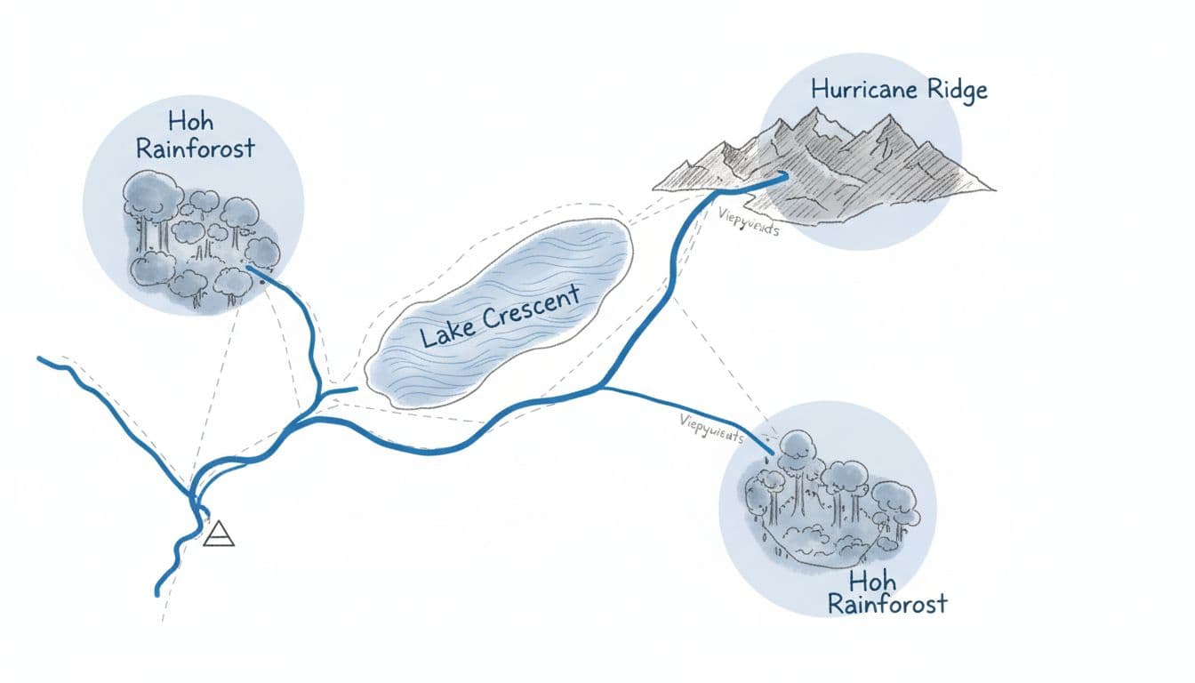
Here is the quick way to size up the map:
| Zone | What it is best for | Gateway town |
|---|---|---|
| North | Mountain views, lakes, and the easiest access | Port Angeles |
| West | Temperate rain forest and wild Pacific beaches | Forks |
| South | Quieter rain forest around Lake Quinault | Quinault |
If you remember one rule, do not try to cross the peninsula twice in one day.
That simple shift saves a lot of frustration. Pick a base, build around it, and the rest of the planning gets much easier. For a full list of standout trails across the state, see the best hikes in Washington, which covers Olympic alongside the Cascades and Mount Rainier.
The first areas to circle on the map
Hurricane Ridge gives the fastest payoff
Hurricane Ridge is the first circle on most first-trip maps. It delivers huge subalpine mountain views without a huge hike, which matters when time is short. It also sits about 17 miles up a paved road from Port Angeles, so the logistics are simple compared with the rest of the park.

Two things are worth knowing before you go. First, Hurricane Ridge Road can close in winter and during bad weather, so it is most dependable from late spring through early fall. Second, services at the top are limited. The historic Hurricane Ridge Day Lodge burned down in May 2023 and has not been rebuilt, so there is no cafe or gift shop and no drinking water at the ridge. Restrooms are available in temporary facilities. Fill your water bottles in Port Angeles before you drive up.
One current note for 2026: a water system project means the short Hurricane Hill Road past the main parking area is closed Monday through Thursday through June 30, reopening on weekends. The main Hurricane Ridge Road stays open throughout, so the viewpoints and meadow trails near the parking area remain reachable. Always check the morning road report before committing.
Lake Crescent and Sol Duc are the smartest backup zone
Lake Crescent is the most reliable north-side stop when weather or snow interferes with the higher roads. It is easy to reach off US 101, beautiful in any light, and beginner-friendly. For a mellow first day, this area is hard to beat.
The zone gives you choices. Keep it light with lake viewpoints and short walks, or add the Marymere Falls trail, a 1.8-mile out-and-back through old-growth forest to a 90-foot waterfall. Stronger hikers can take on Mount Storm King, a short but strenuous climb with rope-assisted sections near the top and a big payoff view over the lake. A little farther west, the Sol Duc Valley adds Sol Duc Falls, an easy 1.6-mile round trip to one of the park’s most photographed cascades, plus a hot springs resort if you want a soak after the trail.
For beginners, pairing Hurricane Ridge with Lake Crescent and Sol Duc is the north-side sweet spot. You get scenery, manageable driving, and a built-in safety net if the mountain plan falls apart.
Rain forest and coast on the west side
The Hoh Rain Forest is the area most people picture when they think of Olympic, and it earns the reputation. Mossy maples and towering conifers make the forest feel like a green cathedral, and my friend Andy’s Hoh Rain Forest photo gallery captures the look better than any description. Two short loops start near the visitor center: the Hall of Mosses at 0.8 miles and the Spruce Nature Trail at about 1.2 miles. The Hoh sits at the end of a long dead-end road off US 101, so it works best as its own half-day rather than a quick add-on.
For the coast, three beaches stand out. Rialto Beach near Mora is known for its sea stacks and the Hole-in-the-Wall arch at low tide. Ruby Beach, farther south near Kalaloch, is one of the simplest places to get that first wild-ocean payoff straight from the parking area. Second Beach, reached by a short forested trail from La Push, rewards the walk with driftwood and offshore rocks. Check a tide chart before any beach walk, since several routes are only passable at lower tides.
Road work and washouts do move around on the west side from season to season, so confirm access to your chosen beach on the park conditions page before you drive out. If one beach is affected by construction, another is usually open nearby.
A realistic first-trip plan
For a short trip, keep it simple. With two days, base in Port Angeles, visit Hurricane Ridge on a clear morning, then add Lake Crescent or a coastal stop. With three days, shift west for a night and add the Hoh Rain Forest plus a beach. If you want that laid out day by day, the Olympic National Park 2-to-4-day hiking itinerary is the natural next step.
Getting there is part of the plan too. From Seattle, Port Angeles is roughly two and a half to three hours, and the most scenic route includes a Washington State Ferry across Puget Sound before you connect to US 101.
The best use of an olympic national park map is focus. Pick one north-side anchor, add one west-side area, and stop there. That may sound conservative, but it gives you better hikes, less driving, and more time to notice why Olympic feels so special. If you are mapping out a bigger Washington road trip, the Mount Rainier map guide and the North Cascades map guide use the same zone-first approach.
FAQs
What area should you focus on first in Olympic National Park?
Start on the north side. Hurricane Ridge, Lake Crescent, and the Sol Duc Valley give you the best mix of mountain views, short drives, and flexible backups, all within reach of Port Angeles.
How much does it cost to enter Olympic National Park?
A private vehicle pass is $30 and is valid for seven consecutive days. The park is cashless, so pay by card or buy a digital pass in advance. An America the Beautiful annual pass also covers entry.
Can you drive across Olympic National Park?
No. There is no road through the middle of the park. You reach each area on spur roads off US 101, which loops around the outside of the peninsula, so traveling between regions means driving the perimeter.
When is the best time to visit Olympic National Park?
July through September offers the most reliable access, including Hurricane Ridge Road and the high country. The rain forest and lower-elevation coast are open year-round, but mountain roads can close in winter and during storms.